
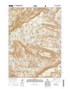
~ Severe Spring ID topo map, 1:24000 scale, 7.5 X 7.5 Minute, Current, 2013
Severe Spring, Idaho, USGS topographic map dated 2013.
Includes geographic coordinates (latitude and longitude). This topographic map is suitable for hiking, camping, and exploring, or framing it as a wall map.
Printed on-demand using high resolution imagery, on heavy weight and acid free paper, or alternatively on a variety of synthetic materials.
Topos available on paper, Waterproof, Poly, or Tyvek. Usually shipping rolled, unless combined with other folded maps in one order.
- Product Number: USGS-7753226
- Free digital map download (high-resolution, GeoPDF): Severe Spring, Idaho (file size: 31 MB)
- Map Size: please refer to the dimensions of the GeoPDF map above
- Weight (paper map): ca. 55 grams
- Map Type: POD USGS Topographic Map
- Map Series: US Topo
- Map Verison: Current
- Cell ID: 40669
- Datum: North American Datum of 1983
- Map Projection: Transverse Mercator
- Map Cell Name: Severe Spring
- Grid size: 7.5 X 7.5 Minute
- Date on map: 2013
- Map Scale: 1:24000
- Geographical region: Idaho, United States
Neighboring Maps:
All neighboring USGS topo maps are available for sale online at a variety of scales.
Spatial coverage:
Topo map Severe Spring, Idaho, covers the geographical area associated the following places:
- Ibex Hollow - Big Pipe Spring - Dry Fork - North Water Spring - Chokecherry Spring - Rodeo Creek - Upper Squaw Creek Spring - Aspen Spring - Little Squaw Creek - Cedar Birch Spring - Oakley Division - Little Squaw Creek Spring - Billys Hole Creek - Buckbrush Spring - South Cottonwood Spring - Dummer Spring - Dry Fork - Dry Fork Spring - Squaw Creek - Severe Spring - Buck Corral Creek - Little Cottonwood Spring - Terrells Corral Creek - Violets Hollow - Layton Spring - Durfee Meadow - Dry Fork Little Cottonwood Creek - Fall Creek - Birch Spring
- Map Area ID: AREA42.2542.125-114.125-114
- Northwest corner Lat/Long code: USGSNW42.25-114.125
- Northeast corner Lat/Long code: USGSNE42.25-114
- Southwest corner Lat/Long code: USGSSW42.125-114.125
- Southeast corner Lat/Long code: USGSSE42.125-114
- Northern map edge Latitude: 42.25
- Southern map edge Latitude: 42.125
- Western map edge Longitude: -114.125
- Eastern map edge Longitude: -114


