
~ Rooster Comb Peak ID topo map, 1:24000 scale, 7.5 X 7.5 Minute, Current, 2013
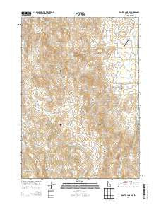
Rooster Comb Peak, Idaho, USGS topographic map dated 2013.
Includes geographic coordinates (latitude and longitude). This topographic map is suitable for hiking, camping, and exploring, or framing it as a wall map.
Printed on-demand using high resolution imagery, on heavy weight and acid free paper, or alternatively on a variety of synthetic materials.
Topos available on paper, Waterproof, Poly, or Tyvek. Usually shipping rolled, unless combined with other folded maps in one order.
- Product Number: USGS-7753000
- Free digital map download (high-resolution, GeoPDF): Rooster Comb Peak, Idaho (file size: 30 MB)
- Map Size: please refer to the dimensions of the GeoPDF map above
- Weight (paper map): ca. 55 grams
- Map Type: POD USGS Topographic Map
- Map Series: US Topo
- Map Verison: Current
- Cell ID: 38540
- Datum: North American Datum of 1983
- Map Projection: Transverse Mercator
- Map Cell Name: Rooster Comb Peak
- Grid size: 7.5 X 7.5 Minute
- Date on map: 2013
- Map Scale: 1:24000
- Geographical region: Idaho, United States
Neighboring Maps:
All neighboring USGS topo maps are available for sale online at a variety of scales.
Spatial coverage:
Topo map Rooster Comb Peak, Idaho, covers the geographical area associated the following places:
- North Fork Macks Creek - South Fork Macks Creek - Crows Nest Creek - China Flat - Alkali Creek - Babbington Creek - Crane Creek - Granite Creek - Granite Spring - Rooster Comb Peak - Babbington Spring Number 2 - Macks Creek Spring - Boghole Spring - Share (historical) - Chipmunk Meadow - Stove Spring - Coal Bank - Bergh Mine - Figure Four Creek - Whiskey Mountain - Macks Creek - Gardner Gulch - Ida Belle Mine - Johnston Draw - Crows Nest Spring - Crows Nest - Crest Spring - Hamilton Gulch - Twin Spring - Z X Ranch Airport - Coal Spring - Cold Spring - Wood Road Gulch - Cottle Creek - Sheep Creek - Monarca Mine - Cottle Lake - Little Cottonwood Creek
- Map Area ID: AREA43.2543.125-116.875-116.75
- Northwest corner Lat/Long code: USGSNW43.25-116.875
- Northeast corner Lat/Long code: USGSNE43.25-116.75
- Southwest corner Lat/Long code: USGSSW43.125-116.875
- Southeast corner Lat/Long code: USGSSE43.125-116.75
- Northern map edge Latitude: 43.25
- Southern map edge Latitude: 43.125
- Western map edge Longitude: -116.875
- Eastern map edge Longitude: -116.75


