
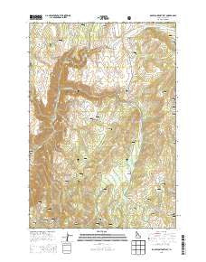
~ Rocky Comfort Flat ID topo map, 1:24000 scale, 7.5 X 7.5 Minute, Current, 2013
Rocky Comfort Flat, Idaho, USGS topographic map dated 2013.
Includes geographic coordinates (latitude and longitude). This topographic map is suitable for hiking, camping, and exploring, or framing it as a wall map.
Printed on-demand using high resolution imagery, on heavy weight and acid free paper, or alternatively on a variety of synthetic materials.
Topos available on paper, Waterproof, Poly, or Tyvek. Usually shipping rolled, unless combined with other folded maps in one order.
- Product Number: USGS-7752990
- Free digital map download (high-resolution, GeoPDF): Rocky Comfort Flat, Idaho (file size: 32 MB)
- Map Size: please refer to the dimensions of the GeoPDF map above
- Weight (paper map): ca. 55 grams
- Map Type: POD USGS Topographic Map
- Map Series: US Topo
- Map Verison: Current
- Cell ID: 38365
- Datum: North American Datum of 1983
- Map Projection: Transverse Mercator
- Map Cell Name: Rocky Comfort Flat
- Grid size: 7.5 X 7.5 Minute
- Date on map: 2013
- Map Scale: 1:24000
- Geographical region: Idaho, United States
Neighboring Maps:
All neighboring USGS topo maps are available for sale online at a variety of scales.
Spatial coverage:
Topo map Rocky Comfort Flat, Idaho, covers the geographical area associated the following places:
- Clifton Spring - Ditch Creek - Rocky Comfort Flat - Dick Ross Creek - Summit Gulch - Calf Pen Gulch - North Hornet Mine - Bear Creek - Spring Creek - Happy Hollow Ranch Airport (historical) - Cows Horn Gulch - Road Creek - Steves Creek - Bear Creek Falls - Gladheart Gulch - Lafferty Campground - Lick Creek - Moonshine Creek - Thorn Creek - Paradise Flat - Williams Creek - Wickiup Creek - Coyote Gulch - Trail Hill - Crooked River - Cottonwood Corrals - Flat Creek
- Map Area ID: AREA4544.875-116.75-116.625
- Northwest corner Lat/Long code: USGSNW45-116.75
- Northeast corner Lat/Long code: USGSNE45-116.625
- Southwest corner Lat/Long code: USGSSW44.875-116.75
- Southeast corner Lat/Long code: USGSSE44.875-116.625
- Northern map edge Latitude: 45
- Southern map edge Latitude: 44.875
- Western map edge Longitude: -116.75
- Eastern map edge Longitude: -116.625


