
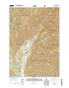
~ Pyle Creek ID topo map, 1:24000 scale, 7.5 X 7.5 Minute, Current, 2013
Pyle Creek, Idaho, USGS topographic map dated 2013.
Includes geographic coordinates (latitude and longitude). This topographic map is suitable for hiking, camping, and exploring, or framing it as a wall map.
Printed on-demand using high resolution imagery, on heavy weight and acid free paper, or alternatively on a variety of synthetic materials.
Topos available on paper, Waterproof, Poly, or Tyvek. Usually shipping rolled, unless combined with other folded maps in one order.
- Product Number: USGS-7752720
- Free digital map download (high-resolution, GeoPDF): Pyle Creek, Idaho (file size: 40 MB)
- Map Size: please refer to the dimensions of the GeoPDF map above
- Weight (paper map): ca. 55 grams
- Map Type: POD USGS Topographic Map
- Map Series: US Topo
- Map Verison: Current
- Cell ID: 71320
- Datum: North American Datum of 1983
- Map Projection: Transverse Mercator
- Map Cell Name: Pyle Creek
- Grid size: 7.5 X 7.5 Minute
- Date on map: 2013
- Map Scale: 1:24000
- Geographical region: Idaho, United States
Neighboring Maps:
All neighboring USGS topo maps are available for sale online at a variety of scales.
Spatial coverage:
Topo map Pyle Creek, Idaho, covers the geographical area associated the following places:
- Scriver Creek - One Spoon Campground (historical) - Hardscrabble Pasture (historical) - Pyle Creek - Bell Creek - Hardscrabble Campground - Easley Creek - Little Gooseberry Creek - Bingo Creek - Hardscrabble Guard Station (historical) - Bear Wallow Point - Terrace Lakes Resort - Hardscrabble Pasture - Auglebright Gulch - Smith Creek - Boom Creek - Tie Creek Campground - Big Bulldog Creek - Tie Creek - Lightning Creek - Pinney Creek - Koppes Creek - West Fork Scriver Creek - Bear Wallow Creek - Powderhouse Gulch - One Spoon Way (historical) - Packer Spring - Warm Springs Creek - Little Bulldog Creek - Wildcat Creek - Pyle Creek Point - Skid Road Creek - Hot Springs - Middle Fork Christian School
- Map Area ID: AREA44.2544.125-116-115.875
- Northwest corner Lat/Long code: USGSNW44.25-116
- Northeast corner Lat/Long code: USGSNE44.25-115.875
- Southwest corner Lat/Long code: USGSSW44.125-116
- Southeast corner Lat/Long code: USGSSE44.125-115.875
- Northern map edge Latitude: 44.25
- Southern map edge Latitude: 44.125
- Western map edge Longitude: -116
- Eastern map edge Longitude: -115.875


