
~ Inferno Cone ID topo map, 1:24000 scale, 7.5 X 7.5 Minute, Current, 2013
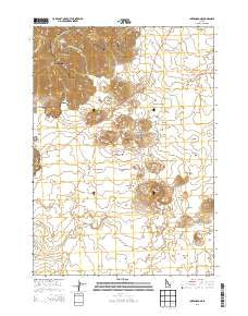
Inferno Cone, Idaho, USGS topographic map dated 2013.
Includes geographic coordinates (latitude and longitude). This topographic map is suitable for hiking, camping, and exploring, or framing it as a wall map.
Printed on-demand using high resolution imagery, on heavy weight and acid free paper, or alternatively on a variety of synthetic materials.
Topos available on paper, Waterproof, Poly, or Tyvek. Usually shipping rolled, unless combined with other folded maps in one order.
- Product Number: USGS-7733179
- Free digital map download (high-resolution, GeoPDF): Inferno Cone, Idaho (file size: 27 MB)
- Map Size: please refer to the dimensions of the GeoPDF map above
- Weight (paper map): ca. 55 grams
- Map Type: POD USGS Topographic Map
- Map Series: US Topo
- Map Verison: Current
- Cell ID: 21923
- Datum: North American Datum of 1983
- Map Projection: Transverse Mercator
- Map Cell Name: Inferno Cone
- Grid size: 7.5 X 7.5 Minute
- Date on map: 2013
- Map Scale: 1:24000
- Geographical region: Idaho, United States
Neighboring Maps:
All neighboring USGS topo maps are available for sale online at a variety of scales.
Spatial coverage:
Topo map Inferno Cone, Idaho, covers the geographical area associated the following places:
- Martin Mine - Grassy Cone - Derelict Flow - Blue Dragon Flow - Big Cinder Butte - Big Craters Flow - Indian Tunnel - Inferno Cone - Paisley Cone - Crescent Butte - Sawtooth Flow - Yellowjacket Waterhole - North Crater - Half Cone - North Crater Flow - Echo Crater - Craters of the Moon National Monument - Craters of the Moon National Wilderness Area - Little Cottonwood Creek - Snow Cone - North Crater Aa Flow - Lava Cascades - Big Sink Waterhole - Sunset Cone - Crystal Fissure Flow - Devils Orchard - Silent Cone - Little Cottonwood Springs - Coyote Butte - Big Sink - Broken Top - Doves Waterholes - Buffalo Caves Flow - Crystal Pit - Big Craters - Craters of the Moon - Trench Mortar Flat - Tepee Circles
- Map Area ID: AREA43.543.375-113.625-113.5
- Northwest corner Lat/Long code: USGSNW43.5-113.625
- Northeast corner Lat/Long code: USGSNE43.5-113.5
- Southwest corner Lat/Long code: USGSSW43.375-113.625
- Southeast corner Lat/Long code: USGSSE43.375-113.5
- Northern map edge Latitude: 43.5
- Southern map edge Latitude: 43.375
- Western map edge Longitude: -113.625
- Eastern map edge Longitude: -113.5


