
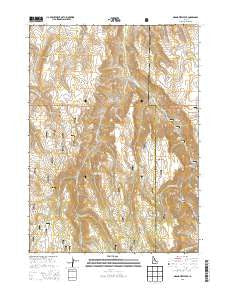
~ Grand View Peak ID topo map, 1:24000 scale, 7.5 X 7.5 Minute, Current, 2013
Grand View Peak, Idaho, USGS topographic map dated 2013.
Includes geographic coordinates (latitude and longitude). This topographic map is suitable for hiking, camping, and exploring, or framing it as a wall map.
Printed on-demand using high resolution imagery, on heavy weight and acid free paper, or alternatively on a variety of synthetic materials.
Topos available on paper, Waterproof, Poly, or Tyvek. Usually shipping rolled, unless combined with other folded maps in one order.
- Product Number: USGS-7732863
- Free digital map download (high-resolution, GeoPDF): Grand View Peak, Idaho (file size: 31 MB)
- Map Size: please refer to the dimensions of the GeoPDF map above
- Weight (paper map): ca. 55 grams
- Map Type: POD USGS Topographic Map
- Map Series: US Topo
- Map Verison: Current
- Cell ID: 18010
- Datum: North American Datum of 1983
- Map Projection: Transverse Mercator
- Map Cell Name: Grand View Peak
- Grid size: 7.5 X 7.5 Minute
- Date on map: 2013
- Map Scale: 1:24000
- Geographical region: Idaho, United States
Neighboring Maps:
All neighboring USGS topo maps are available for sale online at a variety of scales.
Spatial coverage:
Topo map Grand View Peak, Idaho, covers the geographical area associated the following places:
- Three Hundred Thirty Spring Picnic Ground (historical) - Little Creek - Pine Basin - Magpie Basin - Sagehen Spring - Deer Creek - Bluff Creek - Juniper Spring Campground (historical) - Indian Spring Creek - Schipper Campground - Mud Spring - Lincoln Reservoir - Wooden Shoe Creek - Big Bluff Picnic Ground (historical) - Pole Camp Spring - Steer Basin - Donahue Basin - Lucky Gulch - Sagehen Flats - Pine Basin Spring - Grand View Peak - Trail Gulch - Steer Basin Campground - Birch Glen Picnic Ground - Harrington Fork - Sugarloaf - Wooden Shoe Butte - Wooden Shoe Spring - Harrington Fork Picnic Area - Deadeye Spring - Indian Spring - Jones Fork Creek - 330 Spring - Secret Creek - Doodlelink Creek - Buckbrush Flats - Fourth Fork Rock Creek - Fifth Fork Rock Creek - Crockett Spring - Sugarloaf Spring - Coyote Spring - North Willow Springs
- Map Area ID: AREA42.37542.25-114.375-114.25
- Northwest corner Lat/Long code: USGSNW42.375-114.375
- Northeast corner Lat/Long code: USGSNE42.375-114.25
- Southwest corner Lat/Long code: USGSSW42.25-114.375
- Southeast corner Lat/Long code: USGSSE42.25-114.25
- Northern map edge Latitude: 42.375
- Southern map edge Latitude: 42.25
- Western map edge Longitude: -114.375
- Eastern map edge Longitude: -114.25


