
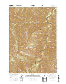
~ Artillery Dome ID topo map, 1:24000 scale, 7.5 X 7.5 Minute, Current, 2013
Artillery Dome, Idaho, USGS topographic map dated 2013.
Includes geographic coordinates (latitude and longitude). This topographic map is suitable for hiking, camping, and exploring, or framing it as a wall map.
Printed on-demand using high resolution imagery, on heavy weight and acid free paper, or alternatively on a variety of synthetic materials.
Topos available on paper, Waterproof, Poly, or Tyvek. Usually shipping rolled, unless combined with other folded maps in one order.
- Product Number: USGS-7731325
- Free digital map download (high-resolution, GeoPDF): Artillery Dome, Idaho (file size: 37 MB)
- Map Size: please refer to the dimensions of the GeoPDF map above
- Weight (paper map): ca. 55 grams
- Map Type: POD USGS Topographic Map
- Map Series: US Topo
- Map Verison: Current
- Cell ID: 1591
- Datum: North American Datum of 1983
- Map Projection: Transverse Mercator
- Map Cell Name: Artillery Dome
- Grid size: 7.5 X 7.5 Minute
- Date on map: 2013
- Map Scale: 1:24000
- Geographical region: Idaho, United States
Neighboring Maps:
All neighboring USGS topo maps are available for sale online at a variety of scales.
Spatial coverage:
Topo map Artillery Dome, Idaho, covers the geographical area associated the following places:
- Sheepeater Hot Springs - Pistol Creek Ranch Landing Strip (historical) - Forty-five Creek - Mule Creek - Sheepeater Hot Springs Campground - Lake Creek - Little Pistol Creek - Quick Stop Campsite - Greyhound Creek Campsite - Pistol Creek Ranch - Lake Creek - Fire Island Campsite - Rapid River - Middle Fork Guard Station - Cap Creek - Artillery Creek - Cow Creek - Oakie Point Campsite - Big Snag Campsite - Beansnapper Creek - Soldier Creek - Pistol Creek Campground - Foresight Creek - Dolly Lake Campsite - Pistol Creek - Pistol Creek Rapids - Artillery Dome - Dome Creek - Cannon Creek - Lake Creek Campsite - Dome House Campsite - Ranch Creek - Twenty-five Creek - Thirty-two Creek - Grenade Creek - Joe Bump Cabin - Mortar Creek - Greyhound Creek - Powerhouse Rapids - Garden Creek - Jons Camp Campsite - Artillery Lake
- Map Area ID: AREA44.7544.625-115.25-115.125
- Northwest corner Lat/Long code: USGSNW44.75-115.25
- Northeast corner Lat/Long code: USGSNE44.75-115.125
- Southwest corner Lat/Long code: USGSSW44.625-115.25
- Southeast corner Lat/Long code: USGSSE44.625-115.125
- Northern map edge Latitude: 44.75
- Southern map edge Latitude: 44.625
- Western map edge Longitude: -115.25
- Eastern map edge Longitude: -115.125


