
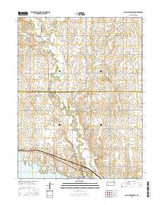
~ Glen Elder North KS topo map, 1:24000 scale, 7.5 X 7.5 Minute, 2015
Glen Elder North, Kansas, USGS topographic map dated 2015.
Includes geographic coordinates (latitude and longitude). This topographic map is suitable for hiking, camping, and exploring, or framing it as a wall map.
Printed on-demand using high resolution imagery, on heavy weight and acid free paper, or alternatively on a variety of synthetic materials.
Topos available on paper, Waterproof, Poly, or Tyvek. Usually shipping rolled, unless combined with other folded maps in one order.
- Product Number: USGS-7729193
- Free digital map download (high-resolution, GeoPDF): Glen Elder North, Kansas (file size: 22 MB)
- Map Size: please refer to the dimensions of the GeoPDF map above
- Weight (paper map): ca. 55 grams
- Map Type: POD USGS Topographic Map
- Map Series: US Topo
- Map Verison: Current
- Cell ID: 17408
- Datum: North American Datum of 1983
- Map Projection: Transverse Mercator
- Map Cell Name: Glen Elder North
- Grid size: 7.5 X 7.5 Minute
- Date on map: 2015
- Map Scale: 1:24000
- Geographical region: Kansas, United States
Neighboring Maps:
All neighboring USGS topo maps are available for sale online at a variety of scales.
Spatial coverage:
Topo map Glen Elder North, Kansas, covers the geographical area associated the following places:
- Glen Elder State Park Osage Campground - Glen Elder State Park - Disappointment Creek - Glen Elder State Park Kanza Campground - Athens School - Glen Elder State Park Kaw Campground - Spring Branch - Glen Elder State Park Rangers Office - Mitchell County Rural Fire District 3 Station C - Hermes Creek - West Limestone Creek - City of Glen Elder - Athens (historical) - Athens Cemetery - Glen Elder Friends Church - Township of Athens - Glen Elder State Park Visitors Center - Glen Elder State Park Arikaree Campground - Glen Elder State Park Kiowa Campground - Glen Elder State Park Sioux Campground - Glen Elder State Park Uskuts Campground - Glenwood Cemetery - Township of Glen Elder - Glen Elder State Park Cheyenne Campground - Glen Elder Christian Church - Lakeside Elementary School - Glen Elder - Ash Creek
- Map Area ID: AREA39.62539.5-98.375-98.25
- Northwest corner Lat/Long code: USGSNW39.625-98.375
- Northeast corner Lat/Long code: USGSNE39.625-98.25
- Southwest corner Lat/Long code: USGSSW39.5-98.375
- Southeast corner Lat/Long code: USGSSE39.5-98.25
- Northern map edge Latitude: 39.625
- Southern map edge Latitude: 39.5
- Western map edge Longitude: -98.375
- Eastern map edge Longitude: -98.25


