
~ Lake Afton KS topo map, 1:24000 scale, 7.5 X 7.5 Minute, 2015
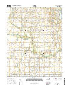
Lake Afton, Kansas, USGS topographic map dated 2015.
Includes geographic coordinates (latitude and longitude). This topographic map is suitable for hiking, camping, and exploring, or framing it as a wall map.
Printed on-demand using high resolution imagery, on heavy weight and acid free paper, or alternatively on a variety of synthetic materials.
Topos available on paper, Waterproof, Poly, or Tyvek. Usually shipping rolled, unless combined with other folded maps in one order.
- Product Number: USGS-7726151
- Free digital map download (high-resolution, GeoPDF): Lake Afton, Kansas (file size: 23 MB)
- Map Size: please refer to the dimensions of the GeoPDF map above
- Weight (paper map): ca. 55 grams
- Map Type: POD USGS Topographic Map
- Map Series: US Topo
- Map Verison: Current
- Cell ID: 70615
- Datum: North American Datum of 1983
- Map Projection: Transverse Mercator
- Map Cell Name: Lake Afton
- Grid size: 7.5 X 7.5 Minute
- Date on map: 2015
- Map Scale: 1:24000
- Geographical region: Kansas, United States
Neighboring Maps:
All neighboring USGS topo maps are available for sale online at a variety of scales.
Spatial coverage:
Topo map Lake Afton, Kansas, covers the geographical area associated the following places:
- Judge James V Riddel Boy's Ranch - Camp Hyde - Venice (historical) - Middle Branch Clearwater Creek - Afton Creek - Spring Creek - Township of Viola - Peotone Cemetery - Lake Afton County Park - North Fork Ninnescah River - Lake Afton - Hovorka Airport (historical) - Township of Afton - Clearwater Creek - Sand Creek - Jocelyn Creek - Polecat Creek - Judge James V Riddel Boys Ranch School - Mod Creek - South Fork Ninnescah River - Clear Creek
- Map Area ID: AREA37.62537.5-97.75-97.625
- Northwest corner Lat/Long code: USGSNW37.625-97.75
- Northeast corner Lat/Long code: USGSNE37.625-97.625
- Southwest corner Lat/Long code: USGSSW37.5-97.75
- Southeast corner Lat/Long code: USGSSE37.5-97.625
- Northern map edge Latitude: 37.625
- Southern map edge Latitude: 37.5
- Western map edge Longitude: -97.75
- Eastern map edge Longitude: -97.625


