
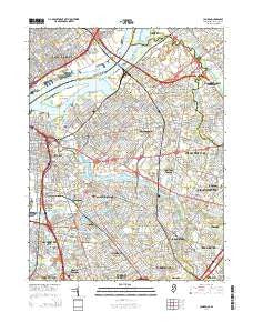
~ Camden NJ topo map, 1:24000 scale, 7.5 X 7.5 Minute, Historical, 2014
Camden, New Jersey, USGS topographic map dated 2014.
Includes geographic coordinates (latitude and longitude). This topographic map is suitable for hiking, camping, and exploring, or framing it as a wall map.
Printed on-demand using high resolution imagery, on heavy weight and acid free paper, or alternatively on a variety of synthetic materials.
Topos available on paper, Waterproof, Poly, or Tyvek. Usually shipping rolled, unless combined with other folded maps in one order.
- Product Number: USGS-7697426
- Free digital map download (high-resolution, GeoPDF): Camden, New Jersey (file size: 35 MB)
- Map Size: please refer to the dimensions of the GeoPDF map above
- Weight (paper map): ca. 55 grams
- Map Type: POD USGS Topographic Map
- Map Series: US Topo
- Map Verison: Historical
- Cell ID: 6850
- Datum: North American Datum of 1983
- Map Projection: Transverse Mercator
- Map Cell Name: Camden
- Grid size: 7.5 X 7.5 Minute
- Date on map: 2014
- Map Scale: 1:24000
- Geographical region: New Jersey, United States
Neighboring Maps:
All neighboring USGS topo maps are available for sale online at a variety of scales.
Spatial coverage:
Topo map Camden, New Jersey, covers the geographical area associated the following places:
- Morris - Delaware Gardens - Haddon Hills - Highland Park - Oaklyn - Brooklawn - Ellisburg - Morgan Village - Delair Junction - Fork Landing - Whitman Park - Haddonfield - Westmont - Golden Triangle - Tavistock - Camden - Meadowbrook - Audubon - Northmont - Wood-Lynne - Cramer Hill - Pavonia - Herwood - Erlton - Windsor Park - Fairview - Cherry Hill Estates - Iron Rock - Tioga Park - Brookfield - Pennsauken - Haddon - Haddon Heights - Morrisville - East Camden - Richmond - Wellwood - Parkside - Columbia Lakes - Merchantville - Locustwood - Port Richmond - Cherry Hill Mall - Parry - Delair - West Haddonfield - West Collingswood Heights - Vernon - Collingswood - Colwick - Gloucester Heights - East Pennsauken - Bon Air - Haddon Towne - Mount Ephraim - Ablett Village - Tyndall Village - Stoys Landing - West Collingswood - Cherry Hill - Jordantown - Audubon Park - Gloucester City - Haddon Leigh
- Map Area ID: AREA4039.875-75.125-75
- Northwest corner Lat/Long code: USGSNW40-75.125
- Northeast corner Lat/Long code: USGSNE40-75
- Southwest corner Lat/Long code: USGSSW39.875-75.125
- Southeast corner Lat/Long code: USGSSE39.875-75
- Northern map edge Latitude: 40
- Southern map edge Latitude: 39.875
- Western map edge Longitude: -75.125
- Eastern map edge Longitude: -75


