
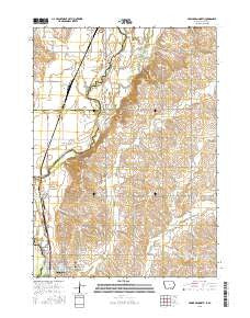
~ Hawarden North IA topo map, 1:24000 scale, 7.5 X 7.5 Minute, 2015
Hawarden North, Iowa, USGS topographic map dated 2015.
Includes geographic coordinates (latitude and longitude). This topographic map is suitable for hiking, camping, and exploring, or framing it as a wall map.
Printed on-demand using high resolution imagery, on heavy weight and acid free paper, or alternatively on a variety of synthetic materials.
Topos available on paper, Waterproof, Poly, or Tyvek. Usually shipping rolled, unless combined with other folded maps in one order.
- Product Number: USGS-7695058
- Free digital map download (high-resolution, GeoPDF): Hawarden North, Iowa (file size: 22 MB)
- Map Size: please refer to the dimensions of the GeoPDF map above
- Weight (paper map): ca. 55 grams
- Map Type: POD USGS Topographic Map
- Map Series: US Topo
- Map Verison: Current
- Cell ID: 19702
- Datum: North American Datum of 1983
- Map Projection: Transverse Mercator
- Map Cell Name: Hawarden North
- Grid size: 7.5 X 7.5 Minute
- Date on map: 2015
- Map Scale: 1:24000
- Geographical region: Iowa, United States
Neighboring Maps:
All neighboring USGS topo maps are available for sale online at a variety of scales.
Spatial coverage:
Topo map Hawarden North, Iowa, covers the geographical area associated the following places:
- Grace Hill Cemetery - Van Driessen Farms - Hawarden Pit - City of Hawarden - Hawarden Elementary School - Sioux Empire College - Daale Farms - West Sioux High School - Calliope Post Office (historical) - Calliope (historical) - Dale Farms - Buncombe Townhall - Calliope Village - Big Sioux Park - Hawarden United Methodist Church - Koenen Farms - K and A Farms - Rock Sioux Access - Rock River - Pattee Creek - Hawarden Community Church - Hillcrest Health Care Center - West Sioux Middle School - Hawarden Municipal Airport - Oak Grove State Park - Hawarden Fire and Rescue - Calvary Cemetery - Longview Farms - School Number 31 (historical) - Township of Buncombe - Haverhals Farm - Hawarden Ambulance Association - Oak Grove Park Campground - Township of Eagle
- Map Area ID: AREA43.12543-96.5-96.375
- Northwest corner Lat/Long code: USGSNW43.125-96.5
- Northeast corner Lat/Long code: USGSNE43.125-96.375
- Southwest corner Lat/Long code: USGSSW43-96.5
- Southeast corner Lat/Long code: USGSSE43-96.375
- Northern map edge Latitude: 43.125
- Southern map edge Latitude: 43
- Western map edge Longitude: -96.5
- Eastern map edge Longitude: -96.375


