
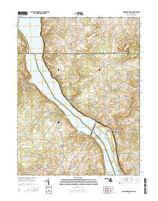
~ Conowingo Dam MD topo map, 1:24000 scale, 7.5 X 7.5 Minute, Historical, 2014
Conowingo Dam, Maryland, USGS topographic map dated 2014.
Includes geographic coordinates (latitude and longitude). This topographic map is suitable for hiking, camping, and exploring, or framing it as a wall map.
Printed on-demand using high resolution imagery, on heavy weight and acid free paper, or alternatively on a variety of synthetic materials.
Topos available on paper, Waterproof, Poly, or Tyvek. Usually shipping rolled, unless combined with other folded maps in one order.
- Product Number: USGS-7692492
- Free digital map download (high-resolution, GeoPDF): Conowingo Dam, Maryland (file size: 34 MB)
- Map Size: please refer to the dimensions of the GeoPDF map above
- Weight (paper map): ca. 55 grams
- Map Type: POD USGS Topographic Map
- Map Series: US Topo
- Map Verison: Historical
- Cell ID: 9885
- Datum: North American Datum of 1983
- Map Projection: Transverse Mercator
- Map Cell Name: Conowingo Dam
- Grid size: 7.5 X 7.5 Minute
- Date on map: 2014
- Map Scale: 1:24000
- Geographical region: Maryland, United States
Neighboring Maps:
All neighboring USGS topo maps are available for sale online at a variety of scales.
Spatial coverage:
Topo map Conowingo Dam, Maryland, covers the geographical area associated the following places:
- Susquehanna Hills - Rowlandsville Heights - Castleton - Bald Friar (historical) - Pilot - Jacks Corner - Darlington - Conowingo - Clearview Court - Gladstone Acres - Richardsmere - Kilby Corner - Conowingo Village - Rowlandsville - Five Points (historical) - Conowingo Manor - Broad Creek Park - Mount Pleasant (historical) - Rock Run Estates - Octoraro Park - Black Baron - Mount Zoar - West Rock Station - Halls Trailer Villa - Hopkins Corner - Rock Springs - Flintville (historical) - Oakwood - Granite Knoll Farms - New Valley - Rock - Lafayettes Crossing - Octoraro - Bald Hill - Whispering Pines - Jenkins Corner - Conowingo Mobile Home Park - Conowingo (historical) - Darlington Mobile Home Park - New Texas - Cardiff - Millers Store - Pleasant Grove - Gallions Corner - Berkley - Sturgill - Red Hill Estates - Topeka East - Red Hill Acres - Head of Canal (historical) - Glen Cove (historical) - The Bluffs
- Map Area ID: AREA39.7539.625-76.25-76.125
- Northwest corner Lat/Long code: USGSNW39.75-76.25
- Northeast corner Lat/Long code: USGSNE39.75-76.125
- Southwest corner Lat/Long code: USGSSW39.625-76.25
- Southeast corner Lat/Long code: USGSSE39.625-76.125
- Northern map edge Latitude: 39.75
- Southern map edge Latitude: 39.625
- Western map edge Longitude: -76.25
- Eastern map edge Longitude: -76.125


