
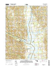
~ Benedict MD topo map, 1:24000 scale, 7.5 X 7.5 Minute, Historical, 2014
Benedict, Maryland, USGS topographic map dated 2014.
Includes geographic coordinates (latitude and longitude). This topographic map is suitable for hiking, camping, and exploring, or framing it as a wall map.
Printed on-demand using high resolution imagery, on heavy weight and acid free paper, or alternatively on a variety of synthetic materials.
Topos available on paper, Waterproof, Poly, or Tyvek. Usually shipping rolled, unless combined with other folded maps in one order.
- Product Number: USGS-7692438
- Free digital map download (high-resolution, GeoPDF): Benedict, Maryland (file size: 34 MB)
- Map Size: please refer to the dimensions of the GeoPDF map above
- Weight (paper map): ca. 55 grams
- Map Type: POD USGS Topographic Map
- Map Series: US Topo
- Map Verison: Historical
- Cell ID: 3315
- Datum: North American Datum of 1983
- Map Projection: Transverse Mercator
- Map Cell Name: Benedict
- Grid size: 7.5 X 7.5 Minute
- Date on map: 2014
- Map Scale: 1:24000
- Geographical region: Maryland, United States
Neighboring Maps:
All neighboring USGS topo maps are available for sale online at a variety of scales.
Spatial coverage:
Topo map Benedict, Maryland, covers the geographical area associated the following places:
- Woodland Acres - Indian Creek Estates - New Enterprise - Maxwell Hall - Poplar Hill - Lowrys Resurvey - Patuxent Woods - Quail Ridge - Cedar Beach - Gibson Meadows - Hallmark Estates - Fox Den - Fiddlers Point - Abington Shores - Potts Point - Hunting Lake - Buena Vista on the Patuxent - Patuxent - Westfield Station - Holland Glenn - Cedar Point - Shady Hill Farm - Calvert Mobile Home Park - Cox - Deerfield - Buena Vista - Shady Hill - Aquasco - Eagle Harbor - Holland Cliff Shores - Burch - The Alameda - Wild Goose Landing - Teagues Point - Cedarhaven - Patuxent View - Deep Landing - Deep Landing Estates - Benedict - Swanson Creek Landing - The Oaks - Meadow Woods Estates - Lowery Oaks - Loves - Anchorage Park Mobile Home Park
- Map Area ID: AREA38.62538.5-76.75-76.625
- Northwest corner Lat/Long code: USGSNW38.625-76.75
- Northeast corner Lat/Long code: USGSNE38.625-76.625
- Southwest corner Lat/Long code: USGSSW38.5-76.75
- Southeast corner Lat/Long code: USGSSE38.5-76.625
- Northern map edge Latitude: 38.625
- Southern map edge Latitude: 38.5
- Western map edge Longitude: -76.75
- Eastern map edge Longitude: -76.625


