
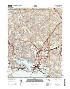
~ Baltimore East MD topo map, 1:24000 scale, 7.5 X 7.5 Minute, Historical, 2014
Baltimore East, Maryland, USGS topographic map dated 2014.
Includes geographic coordinates (latitude and longitude). This topographic map is suitable for hiking, camping, and exploring, or framing it as a wall map.
Printed on-demand using high resolution imagery, on heavy weight and acid free paper, or alternatively on a variety of synthetic materials.
Topos available on paper, Waterproof, Poly, or Tyvek. Usually shipping rolled, unless combined with other folded maps in one order.
- Product Number: USGS-7692424
- Free digital map download (high-resolution, GeoPDF): Baltimore East, Maryland (file size: 37 MB)
- Map Size: please refer to the dimensions of the GeoPDF map above
- Weight (paper map): ca. 55 grams
- Map Type: POD USGS Topographic Map
- Map Series: US Topo
- Map Verison: Historical
- Cell ID: 2293
- Datum: North American Datum of 1983
- Map Projection: Transverse Mercator
- Map Cell Name: Baltimore East
- Grid size: 7.5 X 7.5 Minute
- Date on map: 2014
- Map Scale: 1:24000
- Geographical region: Maryland, United States
Neighboring Maps:
All neighboring USGS topo maps are available for sale online at a variety of scales.
Spatial coverage:
Topo map Baltimore East, Maryland, covers the geographical area associated the following places:
- Armistead Homes - Defense Heights - O'Donnell Heights - Stab - Shoresville (historical) - Frederick Douglass Homes - Rosedale Terrace - Armistead Gardens - Graceland - Lauraville - Baltimore - Rollins View Green - Bluegrass Heights - Waverly - Idlewood - Dundalk Mobile Home Court - Cedarcroft - Fells Point - Waltherson - Parktowne - Broadway-Orleans Homes - Little Italy - Hudson Heights - Riverview (historical) - Beaumont Park - Bellview - Hillbrook - Saint Helena - South Baltimore - Daybreak Estates - Kenilworth Park - Montebello Park - Colgate - Gardenville - Canton - Brooks Hill - Weyburn Park - Hall Spring - Kenwood Park - Holland Hills - Eastfield - Anthonyville - Rosedale - Lutz Hill - Colgate - Woodhome Heights - Cedonia - Homeland - Govanstown - Hamilton - Holabird Homes (historical) - Elmwood - Clarence Perkins Homes - Orangeville - Belmar - Harborview - Mount Vernon - Colgate Creek - High Point - Guilford - Van Dyke Manor - Morgan Park - Pinehurst - Dundalk - Charles Village - Garden Village Park - Latrobe Homes - Kenwood - Linhigh - Ramblewood - Norwood Park - Liberty Mobile Home Park - Old Town - Highlandtown - Belgravia - Gallagher Park - Butchers Hill - Homestead - Fullerton Heights - Fullerton - Beverly Hills - Stanbrook - Hamilton - Eastpoint - Overlea - Goodnow Hill
- Map Area ID: AREA39.37539.25-76.625-76.5
- Northwest corner Lat/Long code: USGSNW39.375-76.625
- Northeast corner Lat/Long code: USGSNE39.375-76.5
- Southwest corner Lat/Long code: USGSSW39.25-76.625
- Southeast corner Lat/Long code: USGSSE39.25-76.5
- Northern map edge Latitude: 39.375
- Southern map edge Latitude: 39.25
- Western map edge Longitude: -76.625
- Eastern map edge Longitude: -76.5


