
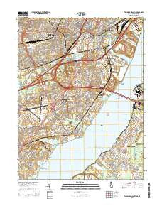
~ Wilmington South DE topo map, 1:24000 scale, 7.5 X 7.5 Minute, Historical, 2014
Wilmington South, Delaware, USGS topographic map dated 2014.
Includes geographic coordinates (latitude and longitude). This topographic map is suitable for hiking, camping, and exploring, or framing it as a wall map.
Printed on-demand using high resolution imagery, on heavy weight and acid free paper, or alternatively on a variety of synthetic materials.
Topos available on paper, Waterproof, Poly, or Tyvek. Usually shipping rolled, unless combined with other folded maps in one order.
- Product Number: USGS-7692210
- Free digital map download (high-resolution, GeoPDF): Wilmington South, Delaware (file size: 38 MB)
- Map Size: please refer to the dimensions of the GeoPDF map above
- Weight (paper map): ca. 55 grams
- Map Type: POD USGS Topographic Map
- Map Series: US Topo
- Map Verison: Historical
- Cell ID: 49298
- Datum: North American Datum of 1983
- Map Projection: Transverse Mercator
- Map Cell Name: Wilmington South
- Grid size: 7.5 X 7.5 Minute
- Date on map: 2014
- Map Scale: 1:24000
- Geographical region: Delaware, United States
Neighboring Maps:
All neighboring USGS topo maps are available for sale online at a variety of scales.
Spatial coverage:
Topo map Wilmington South, Delaware, covers the geographical area associated the following places:
- Belvidere - Prices Corner - Farnhurst - Stockton - Beaver Brook Apartments - Penns Beach - Central Park - Hayden Park - Rose Hill Gardens - Cedar Heights - Bayview Manor - Garfield Park - Minquadale Trailer Village - Lancaster Village - Penn Acres South - Newport Heights - Brookland Terrace - Avalon - Rogers Manor - Landenberg Junction - Ashley - Holloway Terrace - Duross Heights - Church Landing - Silverbrook Gardens - Wood Wards Addition - East Minquadale - Hazeldell - Middleboro Manor - Castle Apartments - Overview Gardens - Swanwyck Gardens - Belmoor - Idela - Clearview Manor - Mayview Manor - Ashley Heights - Wilmington Manor - Willow Run - Latimer Estates - Jefferson Farms - Boxwood - Elsmere - New Castle - Christiana Acres - Colony Hills - Oakmont - West Minquadale - Riveredge Park - Elliots Addition - Claridge Court - Fern Hook - Colonial Heights - South Wilmington - Elmhurst - Masonicville - Hamilton Park - Clearfield - Mahoneyville - Collins Park - Canby Park Estates - Dunleith - Liberty - Lyndalia - Midvale - Simonds Gardens - Manor Park - Chelsea Estates - Llangollen Estates - Castle Hills - Alban Park - Keystone - Hares Corner - Rambleton Acres - Gordy Estates - Silview - Penn Acres - Pennsville - Chelsea Estates - Woodland - Landers Park - Champlin Village - Leedon Estates - Wilmington Manor Gardens - Saienni Farms - Delaware Junction - Newport - Roselle Terrace - Swanwyck - Middleboro East - Cleland Heights - Scarborough Park - Dobbinsville - Churchtown - Landlith - Basin Corner - Colonial Village Apartments - Manor Park Apartments - Tuxedo Park - Forest Park
- Map Area ID: AREA39.7539.625-75.625-75.5
- Northwest corner Lat/Long code: USGSNW39.75-75.625
- Northeast corner Lat/Long code: USGSNE39.75-75.5
- Southwest corner Lat/Long code: USGSSW39.625-75.625
- Southeast corner Lat/Long code: USGSSE39.625-75.5
- Northern map edge Latitude: 39.75
- Southern map edge Latitude: 39.625
- Western map edge Longitude: -75.625
- Eastern map edge Longitude: -75.5


