
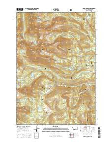
~ Torrey Mountain MT topo map, 1:24000 scale, 7.5 X 7.5 Minute, Current, 2014
Torrey Mountain, Montana, USGS topographic map dated 2014.
Includes geographic coordinates (latitude and longitude). This topographic map is suitable for hiking, camping, and exploring, or framing it as a wall map.
Printed on-demand using high resolution imagery, on heavy weight and acid free paper, or alternatively on a variety of synthetic materials.
Topos available on paper, Waterproof, Poly, or Tyvek. Usually shipping rolled, unless combined with other folded maps in one order.
- Product Number: USGS-7598291
- Free digital map download (high-resolution, GeoPDF): Torrey Mountain, Montana (file size: 38 MB)
- Map Size: please refer to the dimensions of the GeoPDF map above
- Weight (paper map): ca. 55 grams
- Map Type: POD USGS Topographic Map
- Map Series: US Topo
- Map Verison: Current
- Cell ID: 45457
- Datum: North American Datum of 1983
- Map Projection: Transverse Mercator
- Map Cell Name: Torrey Mountain
- Grid size: 7.5 X 7.5 Minute
- Date on map: 2014
- Map Scale: 1:24000
- Geographical region: Montana, United States
Neighboring Maps:
All neighboring USGS topo maps are available for sale online at a variety of scales.
Spatial coverage:
Topo map Torrey Mountain, Montana, covers the geographical area associated the following places:
- Tower Mountain - Mule Creek - Pear Lake Dam - Boot Lake Dam - Winkley Camp - US Treasurer Mine - Indian Squaw Mine - Anchor Lake North Dam - Barb Mountain - Glacier Lake - Dearhead Lake Dam - Torrey Mountain - Lily Lake - Tent Mountain - Boot Lake - Torrey Lake - Gorge Creek - South Fork Thief Creek - Tub Lake Dam - Deerhead Lake - Humbolt Mountain Mine - Gorge Lakes - Buckhorn Creek - Deerhead Lake - Tub Lake - Minneopa Lake - Pear Lake - May Lake - Tweedy Mountain - Tent Lake - Anchor South Dam - Barb Lake - Twin Lakes - Bond Lake - Pioneer Mountains - Boatman Lake - Uphill Creek - Mast Ditch - Dinner Station Campground - Estler Creek
- Map Area ID: AREA45.545.375-113-112.875
- Northwest corner Lat/Long code: USGSNW45.5-113
- Northeast corner Lat/Long code: USGSNE45.5-112.875
- Southwest corner Lat/Long code: USGSSW45.375-113
- Southeast corner Lat/Long code: USGSSE45.375-112.875
- Northern map edge Latitude: 45.5
- Southern map edge Latitude: 45.375
- Western map edge Longitude: -113
- Eastern map edge Longitude: -112.875


