
~ Swede Gulch MT topo map, 1:24000 scale, 7.5 X 7.5 Minute, Current, 2014
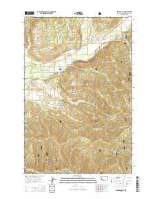
Swede Gulch, Montana, USGS topographic map dated 2014.
Includes geographic coordinates (latitude and longitude). This topographic map is suitable for hiking, camping, and exploring, or framing it as a wall map.
Printed on-demand using high resolution imagery, on heavy weight and acid free paper, or alternatively on a variety of synthetic materials.
Topos available on paper, Waterproof, Poly, or Tyvek. Usually shipping rolled, unless combined with other folded maps in one order.
- Product Number: USGS-7597593
- Free digital map download (high-resolution, GeoPDF): Swede Gulch, Montana (file size: 38 MB)
- Map Size: please refer to the dimensions of the GeoPDF map above
- Weight (paper map): ca. 55 grams
- Map Type: POD USGS Topographic Map
- Map Series: US Topo
- Map Verison: Current
- Cell ID: 43999
- Datum: North American Datum of 1983
- Map Projection: Transverse Mercator
- Map Cell Name: Swede Gulch
- Grid size: 7.5 X 7.5 Minute
- Date on map: 2014
- Map Scale: 1:24000
- Geographical region: Montana, United States
Neighboring Maps:
All neighboring USGS topo maps are available for sale online at a variety of scales.
Spatial coverage:
Topo map Swede Gulch, Montana, covers the geographical area associated the following places:
- Last Chance Mine - Mill Site Mine - Lincoln Rural Fire District Station 3 - Rochester Post Office (historical) - Columbia Mine - NW NW Section 18 Mine - Little Gulch - SE SW Section 4 Mine - Ripley Mill - Davis Gulch - Black Diamond Creek - Landers Fork - 14N08W22BBAD01 Well - 14N07W05CDD_01 Well - Annis Post Office (historical) - Grosfield Ditch - Prickly Gulch - Silver Beel Mine - Swede Hollow - Lincoln Division - Aspen Grove Campground - Ethel Gulch - 14N08W22BBD_01 Well - Rochester Gulch - South Fork Humbug Creek - Hogum Creek - Delany Mill - Seven Up Pete Ranch - SW SE Section 8 Mine - Swansea Tailings - Swansea Mine - Seven-up-Pete Creek - Swede Gulch - Swansea Mine - Silver Bell Mine - Long Gulch - Seven Up Pete Mine - Humbug Creek - SE NE Section 8 Mine - 14N07W05CDD_02 Well - Rover Mine - Crater Mountain - Lincoln Community Ambulance Service Station 3 - 14N07W05CDA_01 Well - 14N07W05CAC_01 Well
- Map Area ID: AREA4746.875-112.625-112.5
- Northwest corner Lat/Long code: USGSNW47-112.625
- Northeast corner Lat/Long code: USGSNE47-112.5
- Southwest corner Lat/Long code: USGSSW46.875-112.625
- Southeast corner Lat/Long code: USGSSE46.875-112.5
- Northern map edge Latitude: 47
- Southern map edge Latitude: 46.875
- Western map edge Longitude: -112.625
- Eastern map edge Longitude: -112.5


