
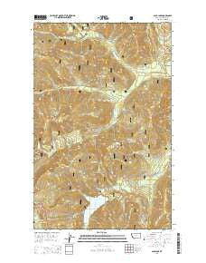
~ Spar Lake MT topo map, 1:24000 scale, 7.5 X 7.5 Minute, Current, 2014
Spar Lake, Montana, USGS topographic map dated 2014.
Includes geographic coordinates (latitude and longitude). This topographic map is suitable for hiking, camping, and exploring, or framing it as a wall map.
Printed on-demand using high resolution imagery, on heavy weight and acid free paper, or alternatively on a variety of synthetic materials.
Topos available on paper, Waterproof, Poly, or Tyvek. Usually shipping rolled, unless combined with other folded maps in one order.
- Product Number: USGS-7597403
- Free digital map download (high-resolution, GeoPDF): Spar Lake, Montana (file size: 39 MB)
- Map Size: please refer to the dimensions of the GeoPDF map above
- Weight (paper map): ca. 55 grams
- Map Type: POD USGS Topographic Map
- Map Series: US Topo
- Map Verison: Current
- Cell ID: 42402
- Datum: North American Datum of 1983
- Map Projection: Transverse Mercator
- Map Cell Name: Spar Lake
- Grid size: 7.5 X 7.5 Minute
- Date on map: 2014
- Map Scale: 1:24000
- Geographical region: Montana, United States
Neighboring Maps:
All neighboring USGS topo maps are available for sale online at a variety of scales.
Spatial coverage:
Topo map Spar Lake, Montana, covers the geographical area associated the following places:
- Fairway Creek - Spar Lake Campground - Lime Butte - Grouse Mountain Number 2 Mine - Bimetalic Mine - Keeler Mountain - Grouse Mountain Number 5 Mine - Hiatt Creek - Thicket Creek - Spruce Lake - South Fork Keeler Creek - Pony Mountain - Grouse Lake Trail - Keeler Mountain Lookout Station - Briar Creek - Grouse Lake - Twilight Creek - Whoopee Creek - Drift Creek - Carr Draw - Spar Lake - Club Creek - Spar Creek - Surprise Draw - Blue Bird Mine - Spruce Mountain - Stanley Mountain - Stanley Peak - North Fork Keeler Creek
- Map Area ID: AREA48.37548.25-116-115.875
- Northwest corner Lat/Long code: USGSNW48.375-116
- Northeast corner Lat/Long code: USGSNE48.375-115.875
- Southwest corner Lat/Long code: USGSSW48.25-116
- Southeast corner Lat/Long code: USGSSE48.25-115.875
- Northern map edge Latitude: 48.375
- Southern map edge Latitude: 48.25
- Western map edge Longitude: -116
- Eastern map edge Longitude: -115.875


