
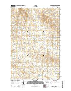
~ South Fork Reservoir MT topo map, 1:24000 scale, 7.5 X 7.5 Minute, Current, 2014
South Fork Reservoir, Montana, USGS topographic map dated 2014.
Includes geographic coordinates (latitude and longitude). This topographic map is suitable for hiking, camping, and exploring, or framing it as a wall map.
Printed on-demand using high resolution imagery, on heavy weight and acid free paper, or alternatively on a variety of synthetic materials.
Topos available on paper, Waterproof, Poly, or Tyvek. Usually shipping rolled, unless combined with other folded maps in one order.
- Product Number: USGS-7597335
- Free digital map download (high-resolution, GeoPDF): South Fork Reservoir, Montana (file size: 28 MB)
- Map Size: please refer to the dimensions of the GeoPDF map above
- Weight (paper map): ca. 55 grams
- Map Type: POD USGS Topographic Map
- Map Series: US Topo
- Map Verison: Current
- Cell ID: 42182
- Datum: North American Datum of 1983
- Map Projection: Transverse Mercator
- Map Cell Name: South Fork Reservoir
- Grid size: 7.5 X 7.5 Minute
- Date on map: 2014
- Map Scale: 1:24000
- Geographical region: Montana, United States
Neighboring Maps:
All neighboring USGS topo maps are available for sale online at a variety of scales.
Spatial coverage:
Topo map South Fork Reservoir, Montana, covers the geographical area associated the following places:
- 14N47E26CDCB01 Well - South Fork Reservoir - Highland School (historical) - 14N48E05CACD01 Well - Sig Spring - South Fork Cherry Creek Dam - 14N48E33ABBC01 Well - 14N47E13ABBA01 Well - Rapos School (historical) - 13N48E09DABC01 Well - 13N48E08DCAA01 Well - Clark Reservoir - Clark Dam - 14N48E18AABD01 Well - South Fork Cherry Creek - 13N47E02BCCC01 Well - Haughian School (historical) - 14N47E26CDCC01 Well - McMillan Post Office (historical) - Morris Creek - 14N48E17CDAB01 Well - 14N47E15DDAD01 Well - Robertson Creek
- Map Area ID: AREA4746.875-105.75-105.625
- Northwest corner Lat/Long code: USGSNW47-105.75
- Northeast corner Lat/Long code: USGSNE47-105.625
- Southwest corner Lat/Long code: USGSSW46.875-105.75
- Southeast corner Lat/Long code: USGSSE46.875-105.625
- Northern map edge Latitude: 47
- Southern map edge Latitude: 46.875
- Western map edge Longitude: -105.75
- Eastern map edge Longitude: -105.625


