
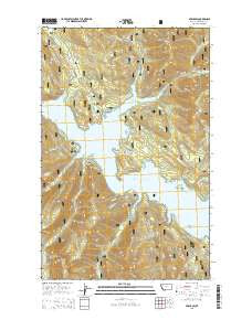
~ Nyack SW MT topo map, 1:24000 scale, 7.5 X 7.5 Minute, Current, 2014
Nyack SW, Montana, USGS topographic map dated 2014.
Includes geographic coordinates (latitude and longitude). This topographic map is suitable for hiking, camping, and exploring, or framing it as a wall map.
Printed on-demand using high resolution imagery, on heavy weight and acid free paper, or alternatively on a variety of synthetic materials.
Topos available on paper, Waterproof, Poly, or Tyvek. Usually shipping rolled, unless combined with other folded maps in one order.
- Product Number: USGS-7551791
- Free digital map download (high-resolution, GeoPDF): Nyack SW, Montana (file size: 37 MB)
- Map Size: please refer to the dimensions of the GeoPDF map above
- Weight (paper map): ca. 55 grams
- Map Type: POD USGS Topographic Map
- Map Series: US Topo
- Map Verison: Current
- Cell ID: 32666
- Datum: North American Datum of 1983
- Map Projection: Transverse Mercator
- Map Cell Name: Nyack SW
- Grid size: 7.5 X 7.5 Minute
- Date on map: 2014
- Map Scale: 1:24000
- Geographical region: Montana, United States
Neighboring Maps:
All neighboring USGS topo maps are available for sale online at a variety of scales.
Spatial coverage:
Topo map Nyack SW, Montana, covers the geographical area associated the following places:
- Endor Creek - Emery Creek Boat Landing - Wounded Buck Vista - Emery Bay - Doris Creek - Fire Creek - Otila Creek - Lost Johnny Boat Landing - Fire Island Campground - Margaret Creek - Solander Creek - Fire Island - Doris Point Campground - Mamie Creek - Argall Creek - Abbot Bay - Hungry Horse Lake - Coram Research Natural Area - Lion Hill Gorge - Doris Point - Alice Creek - Hungry Horse Mountain - Lid Creek Campground - Emery Bay Campground - Firefighter Mountain - Lost Johnny Point - Emery Creek - Hungry Horse Creek - Lost Johnny Campground - Spring Meadow Creek - Ada Creek - Maggie Creek - Lost Johnny Creek - Lid Creek - Wounded Buck Creek - Firefighter Lookout Tower - Lost Johnny Point Campground - Doris Boat Landing
- Map Area ID: AREA48.37548.25-114-113.875
- Northwest corner Lat/Long code: USGSNW48.375-114
- Northeast corner Lat/Long code: USGSNE48.375-113.875
- Southwest corner Lat/Long code: USGSSW48.25-114
- Southeast corner Lat/Long code: USGSSE48.25-113.875
- Northern map edge Latitude: 48.375
- Southern map edge Latitude: 48.25
- Western map edge Longitude: -114
- Eastern map edge Longitude: -113.875


