
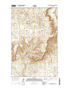
~ Mountain View School MT topo map, 1:24000 scale, 7.5 X 7.5 Minute, Current, 2014
Mountain View School, Montana, USGS topographic map dated 2014.
Includes geographic coordinates (latitude and longitude). This topographic map is suitable for hiking, camping, and exploring, or framing it as a wall map.
Printed on-demand using high resolution imagery, on heavy weight and acid free paper, or alternatively on a variety of synthetic materials.
Topos available on paper, Waterproof, Poly, or Tyvek. Usually shipping rolled, unless combined with other folded maps in one order.
- Product Number: USGS-7551641
- Free digital map download (high-resolution, GeoPDF): Mountain View School, Montana (file size: 25 MB)
- Map Size: please refer to the dimensions of the GeoPDF map above
- Weight (paper map): ca. 55 grams
- Map Type: POD USGS Topographic Map
- Map Series: US Topo
- Map Verison: Current
- Cell ID: 71002
- Datum: North American Datum of 1983
- Map Projection: Transverse Mercator
- Map Cell Name: Mountain View School
- Grid size: 7.5 X 7.5 Minute
- Date on map: 2014
- Map Scale: 1:24000
- Geographical region: Montana, United States
Neighboring Maps:
All neighboring USGS topo maps are available for sale online at a variety of scales.
Spatial coverage:
Topo map Mountain View School, Montana, covers the geographical area associated the following places:
- 35N04W11DD__01 Well - 35N04W12CA__01 Well - 36N04W25AB__01 Well - Rocky Springs (historical) - 36N03W32CD__01 Well - 36N04W22DC__01 Well - Foxtail Lakes - 35N04W03AA__01 Well - Mountain View School (historical) - 36N03W30CB__01 Well - 35N04W12BD__02 Well - 35N04W11DC__02 Well - 35N04W12CB__01 Well - 36N04W35AD__01 Well - 35N04W12CB__02 Well - 35N04W11AA__01 Well - 36N04W34AD__01 Well - 36N04W35AA__01 Well - 36N03W30DD__01 Well - Cowboys Lake - 36N04W22AD__01 Well - 36N04W35AD__02 Well - 35N04W02CA__01 Well - 36N03W19CC__01 Well - 35N04W11DC__01 Well - 35N04W03AA__02 Well - 35N03W18CA__01 Well - Frenchman Lake - 35N04W12BB__01 Well - 35N04W12BC__01 Well - 36N04W36DA__01 Well - 36N03W19BB__01 Well - 35N04W01DB__01 Well - Benton Trail Lakes - 35N04W12BD__01 Well - Kevin Sunburst Oil Field - 36N04W35AB__01 Well
- Map Area ID: AREA48.87548.75-112.125-112
- Northwest corner Lat/Long code: USGSNW48.875-112.125
- Northeast corner Lat/Long code: USGSNE48.875-112
- Southwest corner Lat/Long code: USGSSW48.75-112.125
- Southeast corner Lat/Long code: USGSSE48.75-112
- Northern map edge Latitude: 48.875
- Southern map edge Latitude: 48.75
- Western map edge Longitude: -112.125
- Eastern map edge Longitude: -112


