
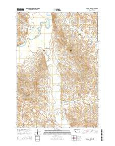
~ Monday Creek MT topo map, 1:24000 scale, 7.5 X 7.5 Minute, Current, 2014
Monday Creek, Montana, USGS topographic map dated 2014.
Includes geographic coordinates (latitude and longitude). This topographic map is suitable for hiking, camping, and exploring, or framing it as a wall map.
Printed on-demand using high resolution imagery, on heavy weight and acid free paper, or alternatively on a variety of synthetic materials.
Topos available on paper, Waterproof, Poly, or Tyvek. Usually shipping rolled, unless combined with other folded maps in one order.
- Product Number: USGS-7551339
- Free digital map download (high-resolution, GeoPDF): Monday Creek, Montana (file size: 29 MB)
- Map Size: please refer to the dimensions of the GeoPDF map above
- Weight (paper map): ca. 55 grams
- Map Type: POD USGS Topographic Map
- Map Series: US Topo
- Map Verison: Current
- Cell ID: 29821
- Datum: North American Datum of 1983
- Map Projection: Transverse Mercator
- Map Cell Name: Monday Creek
- Grid size: 7.5 X 7.5 Minute
- Date on map: 2014
- Map Scale: 1:24000
- Geographical region: Montana, United States
Neighboring Maps:
All neighboring USGS topo maps are available for sale online at a variety of scales.
Spatial coverage:
Topo map Monday Creek, Montana, covers the geographical area associated the following places:
- Hay Creek - 05S52E04DBBC01 Well - Corral Creek - 04S52E23ADDB01 Well - Plum Creek - 04S51E25ACAD01 Well - 04S52E15BDCA01 Well - Bobcat Creek - Little Powder River - Butte Creek - Annis Creek - 04S52E17DAAA01 Well - 04S51E36AC__01 Well - Turnbull Number 1 Dam - Dry Gulch - East Fork Little Powder River - 04S51E13BDBB01 Well - 04S52E21CB__01 Well - 04S52E18BCDC01 Well - Hart Draw - Little Corrall Creek - 05S52E05ADDA01 Well - Little Powder River Fishing Access Site - 04S52E18ACD_01 Well - 03S52E18DACB01 Well - 05S52E08AB__01 Well - Monday Creek - 04S52E20DAAA01 Well - Government Creek - 04S52E29BBDD01 Well - Hell Creek - 05S54E20BB__01 Well - Draine Creek
- Map Area ID: AREA45.545.375-105.375-105.25
- Northwest corner Lat/Long code: USGSNW45.5-105.375
- Northeast corner Lat/Long code: USGSNE45.5-105.25
- Southwest corner Lat/Long code: USGSSW45.375-105.375
- Southeast corner Lat/Long code: USGSSE45.375-105.25
- Northern map edge Latitude: 45.5
- Southern map edge Latitude: 45.375
- Western map edge Longitude: -105.375
- Eastern map edge Longitude: -105.25


