
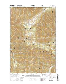
~ Mixes Baldy MT topo map, 1:24000 scale, 7.5 X 7.5 Minute, Current, 2014
Mixes Baldy, Montana, USGS topographic map dated 2014.
Includes geographic coordinates (latitude and longitude). This topographic map is suitable for hiking, camping, and exploring, or framing it as a wall map.
Printed on-demand using high resolution imagery, on heavy weight and acid free paper, or alternatively on a variety of synthetic materials.
Topos available on paper, Waterproof, Poly, or Tyvek. Usually shipping rolled, unless combined with other folded maps in one order.
- Product Number: USGS-7551327
- Free digital map download (high-resolution, GeoPDF): Mixes Baldy, Montana (file size: 37 MB)
- Map Size: please refer to the dimensions of the GeoPDF map above
- Weight (paper map): ca. 55 grams
- Map Type: POD USGS Topographic Map
- Map Series: US Topo
- Map Verison: Current
- Cell ID: 29681
- Datum: North American Datum of 1983
- Map Projection: Transverse Mercator
- Map Cell Name: Mixes Baldy
- Grid size: 7.5 X 7.5 Minute
- Date on map: 2014
- Map Scale: 1:24000
- Geographical region: Montana, United States
Neighboring Maps:
All neighboring USGS topo maps are available for sale online at a variety of scales.
Spatial coverage:
Topo map Mixes Baldy, Montana, covers the geographical area associated the following places:
- Harrison/Moulton Mine - NE SE Section 31 Mine - Frenchies Gulch - Anderson Peak - Niles Post Office (historical) - Peterson Gulch - 16N09E26D___01 Well - Clendenin Mountain - Lone Tree Park - Montgomery Mine - Butcherknife Mountain - Tiger Mine - 16N09E25AB__01 Spring - Martin Spring - Mixes Baldy - Taylor Peak - Berger Creek - NE SW Section 22 Mine - Gray Creek - Geer Post Office (historical) - Lone Tree Park Cemetery - Villars Creek - Peterson Mountain - NW SW Section 22 Mine - Butcherknife Gulch - Taylor Mountain - 16N09E25CC__01 Spring - No Name Gulch - Placer Creek - Blankenship Gulch - Bower Gulch - Moulton Mine - Oti Park
- Map Area ID: AREA47.12547-110.625-110.5
- Northwest corner Lat/Long code: USGSNW47.125-110.625
- Northeast corner Lat/Long code: USGSNE47.125-110.5
- Southwest corner Lat/Long code: USGSSW47-110.625
- Southeast corner Lat/Long code: USGSSE47-110.5
- Northern map edge Latitude: 47.125
- Southern map edge Latitude: 47
- Western map edge Longitude: -110.625
- Eastern map edge Longitude: -110.5


