
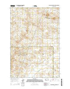
~ Medicine Rocks State Park MT topo map, 1:24000 scale, 7.5 X 7.5 Minute, Current, 2014
Medicine Rocks State Park, Montana, USGS topographic map dated 2014.
Includes geographic coordinates (latitude and longitude). This topographic map is suitable for hiking, camping, and exploring, or framing it as a wall map.
Printed on-demand using high resolution imagery, on heavy weight and acid free paper, or alternatively on a variety of synthetic materials.
Topos available on paper, Waterproof, Poly, or Tyvek. Usually shipping rolled, unless combined with other folded maps in one order.
- Product Number: USGS-7551199
- Free digital map download (high-resolution, GeoPDF): Medicine Rocks State Park, Montana (file size: 25 MB)
- Map Size: please refer to the dimensions of the GeoPDF map above
- Weight (paper map): ca. 55 grams
- Map Type: POD USGS Topographic Map
- Map Series: US Topo
- Map Verison: Current
- Cell ID: 28667
- Datum: North American Datum of 1983
- Map Projection: Transverse Mercator
- Map Cell Name: Medicine Rocks State Park
- Grid size: 7.5 X 7.5 Minute
- Date on map: 2014
- Map Scale: 1:24000
- Geographical region: Montana, United States
Neighboring Maps:
All neighboring USGS topo maps are available for sale online at a variety of scales.
Spatial coverage:
Topo map Medicine Rocks State Park, Montana, covers the geographical area associated the following places:
- Sheep Camp Creek - Red Root Post Office (historical) - Castle Rock - Stone Lady Rock - 03N58E12BDCB01 Well - 04N58E10DDAC01 Well - Roosevelt Rock - Medicine Rocks Church - Medicine Rocks - Hagen Creek - 04N59E10DBBB01 Well - Sikorsky and Sons Dam - 04N58E08BACD01 Well - Medicine Rocks Campground - Alcatraz Rock - 03N58E05AAA_01 Well - Greasewood Creek - 03N59E20BCCB01 Well - Terrell Creek - Medicine Rocks State Park - 04N58E30ADD_01 Well - Sikorski Ranch Airport
- Map Area ID: AREA46.12546-104.5-104.375
- Northwest corner Lat/Long code: USGSNW46.125-104.5
- Northeast corner Lat/Long code: USGSNE46.125-104.375
- Southwest corner Lat/Long code: USGSSW46-104.5
- Southeast corner Lat/Long code: USGSSE46-104.375
- Northern map edge Latitude: 46.125
- Southern map edge Latitude: 46
- Western map edge Longitude: -104.5
- Eastern map edge Longitude: -104.375


