
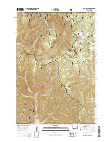
~ Lost Trail Pass MT topo map, 1:24000 scale, 7.5 X 7.5 Minute, Current, 2014
Lost Trail Pass, Montana, USGS topographic map dated 2014.
Includes geographic coordinates (latitude and longitude). This topographic map is suitable for hiking, camping, and exploring, or framing it as a wall map.
Printed on-demand using high resolution imagery, on heavy weight and acid free paper, or alternatively on a variety of synthetic materials.
Topos available on paper, Waterproof, Poly, or Tyvek. Usually shipping rolled, unless combined with other folded maps in one order.
- Product Number: USGS-7551025
- Free digital map download (high-resolution, GeoPDF): Lost Trail Pass, Montana (file size: 37 MB)
- Map Size: please refer to the dimensions of the GeoPDF map above
- Weight (paper map): ca. 55 grams
- Map Type: POD USGS Topographic Map
- Map Series: US Topo
- Map Verison: Current
- Cell ID: 26681
- Datum: North American Datum of 1983
- Map Projection: Transverse Mercator
- Map Cell Name: Lost Trail Pass
- Grid size: 7.5 X 7.5 Minute
- Date on map: 2014
- Map Scale: 1:24000
- Geographical region: Montana, United States
Neighboring Maps:
All neighboring USGS topo maps are available for sale online at a variety of scales.
Spatial coverage:
Topo map Lost Trail Pass, Montana, covers the geographical area associated the following places:
- Saddle Mountain - West Meadow Ski Trail - East Fork Pierce Creek - Moose Creek - Chief Joseph Pass - Speedway Ski Trail - Chicken Out Ski Trail - Hideout Ski Trail - Little Moose Creek - Lost Trail Pass Picnic Area - West Fork North Fork Salmon River - Saddle Mountain Fire Area Poin of Interest - Gibbons Pass - Gallogly Hot Springs - Upper Far Out Ski Trail - South Face Ski Trail - Southern Comfort Ski Trail - State Creek - Anderson Creek - Lost Trail Powder Mountain - Lightning Ski Trail - Lewis and Clark Ridge - Cool Gulch - Thunder Ski Trail - North Bowl Ski Trail - Richardson Creek - Powder Bowl Ski Trail - Meadow Trail Ski Trail - Gallogly Spring - Porcupine Saddle - Scooter Creek - B-2 Ski Trail - Hogans Guard Station - Big Hole National Recreation Trail - Lost Trail Pass - Porcupine Saddle Trailhead - North Face Ski Trail - Prairie Creek - Drifter Ski Trail - Salmon Ski Trail - Meadow Run Ski Trail - Lost Trail Sports Area - Lost Trail Sprots Area - Far Out Ski Trail
- Map Area ID: AREA45.7545.625-114-113.875
- Northwest corner Lat/Long code: USGSNW45.75-114
- Northeast corner Lat/Long code: USGSNE45.75-113.875
- Southwest corner Lat/Long code: USGSSW45.625-114
- Southeast corner Lat/Long code: USGSSE45.625-113.875
- Northern map edge Latitude: 45.75
- Southern map edge Latitude: 45.625
- Western map edge Longitude: -114
- Eastern map edge Longitude: -113.875


