
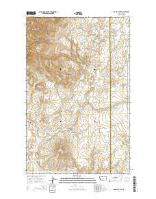
~ Grassy Butte MT topo map, 1:24000 scale, 7.5 X 7.5 Minute, Current, 2014
Grassy Butte, Montana, USGS topographic map dated 2014.
Includes geographic coordinates (latitude and longitude). This topographic map is suitable for hiking, camping, and exploring, or framing it as a wall map.
Printed on-demand using high resolution imagery, on heavy weight and acid free paper, or alternatively on a variety of synthetic materials.
Topos available on paper, Waterproof, Poly, or Tyvek. Usually shipping rolled, unless combined with other folded maps in one order.
- Product Number: USGS-7545806
- Free digital map download (high-resolution, GeoPDF): Grassy Butte, Montana (file size: 25 MB)
- Map Size: please refer to the dimensions of the GeoPDF map above
- Weight (paper map): ca. 55 grams
- Map Type: POD USGS Topographic Map
- Map Series: US Topo
- Map Verison: Current
- Cell ID: 18183
- Datum: North American Datum of 1983
- Map Projection: Transverse Mercator
- Map Cell Name: Grassy Butte
- Grid size: 7.5 X 7.5 Minute
- Date on map: 2014
- Map Scale: 1:24000
- Geographical region: Montana, United States
Neighboring Maps:
All neighboring USGS topo maps are available for sale online at a variety of scales.
Spatial coverage:
Topo map Grassy Butte, Montana, covers the geographical area associated the following places:
- Chicago Lake Dam - Wescott Coulee - Hofer 2 Dam - 36N03E14CCCC01 Well - Hofer 1 Dam - Old Indian Cemetery - Oh Henrys Place Dam - Capacity Dam - La Plante Coulee - T C Morris Ranch - Henry Dam Number 2 - Morris Number 2 Dam - 36N03E14CCCB01 Well - Toole County Waterfowl Production Area - 35N03E20AACC01 Spring - Chicago Lake - 36N03E27BCB01_ Spring - Swanp Cooler Dam - Strawberry Creek - Morris Reservoir - Furnell Ranch - Triple L and ER Fritz Dam - Sleeper Coulee - Jack McDonald Coulee - 35N03E10ABBD01 Well - Spring Coulee - Snow Coulee - 35N03E21BDCD01 Well - Henry Dam Number 1 - Alkali Spring - Middle Butte - Johnson Coulee - Hartsook Ranch - Grassy Butte
- Map Area ID: AREA48.87548.75-111.375-111.25
- Northwest corner Lat/Long code: USGSNW48.875-111.375
- Northeast corner Lat/Long code: USGSNE48.875-111.25
- Southwest corner Lat/Long code: USGSSW48.75-111.375
- Southeast corner Lat/Long code: USGSSE48.75-111.25
- Northern map edge Latitude: 48.875
- Southern map edge Latitude: 48.75
- Western map edge Longitude: -111.375
- Eastern map edge Longitude: -111.25


