
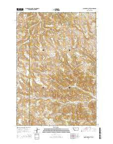
~ Cook Creek Butte MT topo map, 1:24000 scale, 7.5 X 7.5 Minute, Current, 2014
Cook Creek Butte, Montana, USGS topographic map dated 2014.
Includes geographic coordinates (latitude and longitude). This topographic map is suitable for hiking, camping, and exploring, or framing it as a wall map.
Printed on-demand using high resolution imagery, on heavy weight and acid free paper, or alternatively on a variety of synthetic materials.
Topos available on paper, Waterproof, Poly, or Tyvek. Usually shipping rolled, unless combined with other folded maps in one order.
- Product Number: USGS-7540392
- Free digital map download (high-resolution, GeoPDF): Cook Creek Butte, Montana (file size: 35 MB)
- Map Size: please refer to the dimensions of the GeoPDF map above
- Weight (paper map): ca. 55 grams
- Map Type: POD USGS Topographic Map
- Map Series: US Topo
- Map Verison: Current
- Cell ID: 69732
- Datum: North American Datum of 1983
- Map Projection: Transverse Mercator
- Map Cell Name: Cook Creek Butte
- Grid size: 7.5 X 7.5 Minute
- Date on map: 2014
- Map Scale: 1:24000
- Geographical region: Montana, United States
Neighboring Maps:
All neighboring USGS topo maps are available for sale online at a variety of scales.
Spatial coverage:
Topo map Cook Creek Butte, Montana, covers the geographical area associated the following places:
- 05S41E21BBCC01 Spring - 05S41E21DABB01 Spring - 05S41E17ADCD01 Spring - 05S41E27BABD01 Spring - 05N41E28ABCC01 Spring - Saint Johns Spring - 05S41E21CAAA01 Spring - 05S41E07CCDA01 Spring - 05S41E18CBCD01 Spring - Buffalo Jump - 05S41E26ABAC01 Spring - 05S41E28ABC_01 Well - 05S41E22DCDC01 Spring - 05S41E26ABA_01 Well - 05S41E21CAA_01 Well - 05S41E10ACBC01 Spring - Wild Hog Creek - 05S41E16CDDD01 Spring - 05S41E18BBCD01 Spring - 05S41E23DBAA01 Spring - 05S41E20DDDB01 Well - 05S41E27ABBC01 Spring - 05S41E15CBDA01 Spring - Cook Creek Butte - 05S41E23BAAC01 Spring - Muddy School (historical) - 05S41E18BBC_01 Well
- Map Area ID: AREA45.545.375-106.75-106.625
- Northwest corner Lat/Long code: USGSNW45.5-106.75
- Northeast corner Lat/Long code: USGSNE45.5-106.625
- Southwest corner Lat/Long code: USGSSW45.375-106.75
- Southeast corner Lat/Long code: USGSSE45.375-106.625
- Northern map edge Latitude: 45.5
- Southern map edge Latitude: 45.375
- Western map edge Longitude: -106.75
- Eastern map edge Longitude: -106.625


