
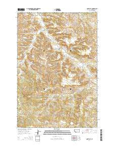
~ Corey Flat MT topo map, 1:24000 scale, 7.5 X 7.5 Minute, Current, 2014
Corey Flat, Montana, USGS topographic map dated 2014.
Includes geographic coordinates (latitude and longitude). This topographic map is suitable for hiking, camping, and exploring, or framing it as a wall map.
Printed on-demand using high resolution imagery, on heavy weight and acid free paper, or alternatively on a variety of synthetic materials.
Topos available on paper, Waterproof, Poly, or Tyvek. Usually shipping rolled, unless combined with other folded maps in one order.
- Product Number: USGS-7540376
- Free digital map download (high-resolution, GeoPDF): Corey Flat, Montana (file size: 35 MB)
- Map Size: please refer to the dimensions of the GeoPDF map above
- Weight (paper map): ca. 55 grams
- Map Type: POD USGS Topographic Map
- Map Series: US Topo
- Map Verison: Current
- Cell ID: 10099
- Datum: North American Datum of 1983
- Map Projection: Transverse Mercator
- Map Cell Name: Corey Flat
- Grid size: 7.5 X 7.5 Minute
- Date on map: 2014
- Map Scale: 1:24000
- Geographical region: Montana, United States
Neighboring Maps:
All neighboring USGS topo maps are available for sale online at a variety of scales.
Spatial coverage:
Topo map Corey Flat, Montana, covers the geographical area associated the following places:
- 09N29E33CBBD01 Well - 08N29E23AADD01 Well - 08N30E32CCCC01 Well - 08N29E22CBAA01 Well - 08N30E06CDBD01 Well - Fishel Creek - Tripod Well - Cory Flat - Melstone Division - 08N30E07BCA_01 Well - Page Well - 08N29E36DBDA01 Well - Musselshell Cemetery - 08N29E33CAA_01 Well
- Map Area ID: AREA46.546.375-108.125-108
- Northwest corner Lat/Long code: USGSNW46.5-108.125
- Northeast corner Lat/Long code: USGSNE46.5-108
- Southwest corner Lat/Long code: USGSSW46.375-108.125
- Southeast corner Lat/Long code: USGSSE46.375-108
- Northern map edge Latitude: 46.5
- Southern map edge Latitude: 46.375
- Western map edge Longitude: -108.125
- Eastern map edge Longitude: -108


