
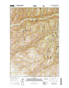
~ Copper Mountain MT topo map, 1:24000 scale, 7.5 X 7.5 Minute, Current, 2014
Copper Mountain, Montana, USGS topographic map dated 2014.
Includes geographic coordinates (latitude and longitude). This topographic map is suitable for hiking, camping, and exploring, or framing it as a wall map.
Printed on-demand using high resolution imagery, on heavy weight and acid free paper, or alternatively on a variety of synthetic materials.
Topos available on paper, Waterproof, Poly, or Tyvek. Usually shipping rolled, unless combined with other folded maps in one order.
- Product Number: USGS-7540374
- Free digital map download (high-resolution, GeoPDF): Copper Mountain, Montana (file size: 36 MB)
- Map Size: please refer to the dimensions of the GeoPDF map above
- Weight (paper map): ca. 55 grams
- Map Type: POD USGS Topographic Map
- Map Series: US Topo
- Map Verison: Current
- Cell ID: 10049
- Datum: North American Datum of 1983
- Map Projection: Transverse Mercator
- Map Cell Name: Copper Mountain
- Grid size: 7.5 X 7.5 Minute
- Date on map: 2014
- Map Scale: 1:24000
- Geographical region: Montana, United States
Neighboring Maps:
All neighboring USGS topo maps are available for sale online at a variety of scales.
Spatial coverage:
Topo map Copper Mountain, Montana, covers the geographical area associated the following places:
- Silver Bullion Mine - Stonewall Creek - Wakefield Creek - Silver Bar Mine - Quartz Hill Trail - NE NE Section 20 Mine - Copper Mountain - Cherry Gulch - Currant Creek - South Fork Mill Creek - Kings Gulch - Hunts Claim Mine - Wrights Mine - Studhorse Creek - Copper Mountain Mine - Sandstrom Mine - Pedro Mine - Cow Creek - Pot Rustler Mine - SE SE Section 11 Mine - Balanced Rock Campground - NW NE Section 30 Mine - Toledo Mine - Goldschmidt-Steiner Mine - Mill Creek Campground - East Fork Quartz Creek - Leggat Creek - Non Pareil Park - SW SW Section 12 Mine - Stonewall (historical) - Bridge Canyon - Harris Creek Talc Mine - Smuggler Mine - North Fork Antelope Creek Mine - Johnson Creek - SE NW Section 36 Mine - Horse Creek Quartz Mine - Nash Group Mine - North Fork Ramshorn Creek - Peacock Creek Trail - NE SW Section 30 Mine - Grandview Mine - Toledo Mine - Paymaster Mine - Donegan Gulch - Paymaster Mine - Latest Out Mine - Currant Creek Trail - 05S04W28BBAB02 Well - Freida Mine - SW NW Section 7 Mine - J and J Mine - Reese Gulch - Eclipse Creek - 05S04W28BBAB01 Well - Jane and Nash Mine - Pedro Trail - Peacock Creek - Agitator/Concentrator Mine - Betsy Baker Mine - Quartz Creek - Cow Creek Trail - Smuggler Mine - Upper Pot Rustler Mine - Sage Hen Mine
- Map Area ID: AREA45.545.375-112.125-112
- Northwest corner Lat/Long code: USGSNW45.5-112.125
- Northeast corner Lat/Long code: USGSNE45.5-112
- Southwest corner Lat/Long code: USGSSW45.375-112.125
- Southeast corner Lat/Long code: USGSSE45.375-112
- Northern map edge Latitude: 45.5
- Southern map edge Latitude: 45.375
- Western map edge Longitude: -112.125
- Eastern map edge Longitude: -112


