
~ Cleveland NW MT topo map, 1:24000 scale, 7.5 X 7.5 Minute, Current, 2014
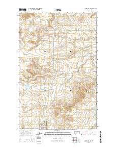
Cleveland NW, Montana, USGS topographic map dated 2014.
Includes geographic coordinates (latitude and longitude). This topographic map is suitable for hiking, camping, and exploring, or framing it as a wall map.
Printed on-demand using high resolution imagery, on heavy weight and acid free paper, or alternatively on a variety of synthetic materials.
Topos available on paper, Waterproof, Poly, or Tyvek. Usually shipping rolled, unless combined with other folded maps in one order.
- Product Number: USGS-7540254
- Free digital map download (high-resolution, GeoPDF): Cleveland NW, Montana (file size: 25 MB)
- Map Size: please refer to the dimensions of the GeoPDF map above
- Weight (paper map): ca. 55 grams
- Map Type: POD USGS Topographic Map
- Map Series: US Topo
- Map Verison: Current
- Cell ID: 9140
- Datum: North American Datum of 1983
- Map Projection: Transverse Mercator
- Map Cell Name: Cleveland NW
- Grid size: 7.5 X 7.5 Minute
- Date on map: 2014
- Map Scale: 1:24000
- Geographical region: Montana, United States
Neighboring Maps:
All neighboring USGS topo maps are available for sale online at a variety of scales.
Spatial coverage:
Topo map Cleveland NW, Montana, covers the geographical area associated the following places:
- 31N20E28CDBD01 Well - New Hope School (historical) - 31N19E13ADBA02 Well - 32N20E34CCBB01 Well - 31N19E13ADBA01 Well - Bean Creek - Red Rock School (historical) - Tiger Number 1 Dam - Garden Dam - Central School (historical) - Bowes Oil Field - Snake Dam - 32N20E33DDAD01 Well - Spring Creek - 32N19E36CDCB01 Well - Olson Road Coulee - Blackjack Mine - Chief Joseph Battleground - Bear Paw Battlefield - Nez Perce National Historical Park - 32N19E36CDCA01 Well - Spring Coulee - 32N20E32DDDC01 Well
- Map Area ID: AREA48.548.375-109.25-109.125
- Northwest corner Lat/Long code: USGSNW48.5-109.25
- Northeast corner Lat/Long code: USGSNE48.5-109.125
- Southwest corner Lat/Long code: USGSSW48.375-109.25
- Southeast corner Lat/Long code: USGSSE48.375-109.125
- Northern map edge Latitude: 48.5
- Southern map edge Latitude: 48.375
- Western map edge Longitude: -109.25
- Eastern map edge Longitude: -109.125


