
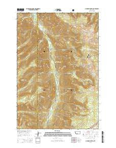
~ Chrome Mountain MT topo map, 1:24000 scale, 7.5 X 7.5 Minute, Current, 2014
Chrome Mountain, Montana, USGS topographic map dated 2014.
Includes geographic coordinates (latitude and longitude). This topographic map is suitable for hiking, camping, and exploring, or framing it as a wall map.
Printed on-demand using high resolution imagery, on heavy weight and acid free paper, or alternatively on a variety of synthetic materials.
Topos available on paper, Waterproof, Poly, or Tyvek. Usually shipping rolled, unless combined with other folded maps in one order.
- Product Number: USGS-7540214
- Free digital map download (high-resolution, GeoPDF): Chrome Mountain, Montana (file size: 37 MB)
- Map Size: please refer to the dimensions of the GeoPDF map above
- Weight (paper map): ca. 55 grams
- Map Type: POD USGS Topographic Map
- Map Series: US Topo
- Map Verison: Current
- Cell ID: 8690
- Datum: North American Datum of 1983
- Map Projection: Transverse Mercator
- Map Cell Name: Chrome Mountain
- Grid size: 7.5 X 7.5 Minute
- Date on map: 2014
- Map Scale: 1:24000
- Geographical region: Montana, United States
Neighboring Maps:
All neighboring USGS topo maps are available for sale online at a variety of scales.
Spatial coverage:
Topo map Chrome Mountain, Montana, covers the geographical area associated the following places:
- Upper Gish Mine - Bonanza Number 3 Mine - Raspberry Creek - Blakely Creek - Firewater Creek - Red Fox Claim Mine - Flemming Bridge - Lower Gish Mine - West Chippy Creek - Chrome Mountain - Gish Mine - Aspen Campground - 04S12E25CBBD02 Well - Froze-to-Death Creek - Camp-on-the-Boulder - Silvertip Creek - Great Falls Creek - Miller Creek - Chippy Park Campground - Middle Gish Mine - Nicon Number 1 Mine - Skillman Mine - Clydehurst Ranch - Big Beaver Campground - Shorty Creek - East Chippy Creek - Hells Canyon Ranch - Falls Creek - Graham Creek - Twomile Bridge - Speculator Creek - Boulder River Number 1 Mine - Falls Creek Campground - Contact Mountain
- Map Area ID: AREA45.545.375-110.25-110.125
- Northwest corner Lat/Long code: USGSNW45.5-110.25
- Northeast corner Lat/Long code: USGSNE45.5-110.125
- Southwest corner Lat/Long code: USGSSW45.375-110.25
- Southeast corner Lat/Long code: USGSSE45.375-110.125
- Northern map edge Latitude: 45.5
- Southern map edge Latitude: 45.375
- Western map edge Longitude: -110.25
- Eastern map edge Longitude: -110.125


