
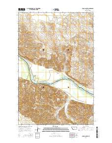
~ Cedar Coulee MT topo map, 1:24000 scale, 7.5 X 7.5 Minute, Current, 2014
Cedar Coulee, Montana, USGS topographic map dated 2014.
Includes geographic coordinates (latitude and longitude). This topographic map is suitable for hiking, camping, and exploring, or framing it as a wall map.
Printed on-demand using high resolution imagery, on heavy weight and acid free paper, or alternatively on a variety of synthetic materials.
Topos available on paper, Waterproof, Poly, or Tyvek. Usually shipping rolled, unless combined with other folded maps in one order.
- Product Number: USGS-7540078
- Free digital map download (high-resolution, GeoPDF): Cedar Coulee, Montana (file size: 30 MB)
- Map Size: please refer to the dimensions of the GeoPDF map above
- Weight (paper map): ca. 55 grams
- Map Type: POD USGS Topographic Map
- Map Series: US Topo
- Map Verison: Current
- Cell ID: 7789
- Datum: North American Datum of 1983
- Map Projection: Transverse Mercator
- Map Cell Name: Cedar Coulee
- Grid size: 7.5 X 7.5 Minute
- Date on map: 2014
- Map Scale: 1:24000
- Geographical region: Montana, United States
Neighboring Maps:
All neighboring USGS topo maps are available for sale online at a variety of scales.
Spatial coverage:
Topo map Cedar Coulee, Montana, covers the geographical area associated the following places:
- 26N57E01DD__01 Well - 27N57E14AA__01 Well - Gettin' High Dam - Coal Coulee - 27N58E07BB__01 Well - 26N58E05AB__01 Well - Deep Coulee - 27N57E01BC__03 Well - 27N57E01BC__01 Well - 27N57E36CD__01 Well - Rocky Point Coulee - Otis Creek - Wells Coulee - 27N57E13CB__01 Well - Harmon Reservoir Dam - 27N58E07BB__02 Well - Star Coulee - 27N57E10BA__01 Well - 26N57E01BB__01 Well - Trudell Number 1 Dam - Becker School (historical) - 26N58E06CC__01 Well - 27N57E10BA__02 Well - 27N57E26DB__01 Well - 27N57E03DB__01 Well - Cedar Coulee - 27N57E02CB__01 Well - 27N58E06BC__01 Well - Leeson School (historical) - 27N57E28BDA_01 Well - 27N57E12BB__01 Well - Harmon Reservoir - 27N57E01BC__02 Well - 27N57E24ACBA01 Well - 27N57E14AA__02 Well
- Map Area ID: AREA48.12548-104.375-104.25
- Northwest corner Lat/Long code: USGSNW48.125-104.375
- Northeast corner Lat/Long code: USGSNE48.125-104.25
- Southwest corner Lat/Long code: USGSSW48-104.375
- Southeast corner Lat/Long code: USGSSE48-104.25
- Northern map edge Latitude: 48.125
- Southern map edge Latitude: 48
- Western map edge Longitude: -104.375
- Eastern map edge Longitude: -104.25


