
~ Capitol Rock MT topo map, 1:24000 scale, 7.5 X 7.5 Minute, Current, 2014
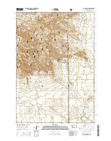
Capitol Rock, Montana, USGS topographic map dated 2014.
Includes geographic coordinates (latitude and longitude). This topographic map is suitable for hiking, camping, and exploring, or framing it as a wall map.
Printed on-demand using high resolution imagery, on heavy weight and acid free paper, or alternatively on a variety of synthetic materials.
Topos available on paper, Waterproof, Poly, or Tyvek. Usually shipping rolled, unless combined with other folded maps in one order.
- Product Number: USGS-7540018
- Free digital map download (high-resolution, GeoPDF): Capitol Rock, Montana (file size: 28 MB)
- Map Size: please refer to the dimensions of the GeoPDF map above
- Weight (paper map): ca. 55 grams
- Map Type: POD USGS Topographic Map
- Map Series: US Topo
- Map Verison: Current
- Cell ID: 7206
- Datum: North American Datum of 1983
- Map Projection: Transverse Mercator
- Map Cell Name: Capitol Rock
- Grid size: 7.5 X 7.5 Minute
- Date on map: 2014
- Map Scale: 1:24000
- Geographical region: Montana, United States
Neighboring Maps:
All neighboring USGS topo maps are available for sale online at a variety of scales.
Spatial coverage:
Topo map Capitol Rock, Montana, covers the geographical area associated the following places:
- Hoag Spring - Abrogast Spring - N F Spring - North Fork Plum Creek - Blocker Field - Whitcomb Draw - Turbiville Irrigation Dam - Capitol Rock - Section 3 Spring - Plainview School (historical) - Craft Spring - West Lindsey Reservoir - North Slope Spring - Livingstone Spring - Lindsey Reservoir - Bucholtz Reservoir - Crase Spring - 03S62E22ABAA01 Well - Benneys Spring - Hoag Coal Mine Draw - Wickham Gulch Campground - West Lindsey Reservoir Dam - D Rayman Ranch - Wickham Spring Number 2 - Old Mill Spring - Wickham Spring Number 1 - Capitol Rock Spring - Catron Well
- Map Area ID: AREA45.62545.5-104.125-104
- Northwest corner Lat/Long code: USGSNW45.625-104.125
- Northeast corner Lat/Long code: USGSNE45.625-104
- Southwest corner Lat/Long code: USGSSW45.5-104.125
- Southeast corner Lat/Long code: USGSSE45.5-104
- Northern map edge Latitude: 45.625
- Southern map edge Latitude: 45.5
- Western map edge Longitude: -104.125
- Eastern map edge Longitude: -104


