
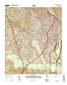
~ Macon West GA topo map, 1:24000 scale, 7.5 X 7.5 Minute, Current, 2014
Macon West, Georgia, USGS topographic map dated 2014.
Includes geographic coordinates (latitude and longitude). This topographic map is suitable for hiking, camping, and exploring, or framing it as a wall map.
Printed on-demand using high resolution imagery, on heavy weight and acid free paper, or alternatively on a variety of synthetic materials.
Topos available on paper, Waterproof, Poly, or Tyvek. Usually shipping rolled, unless combined with other folded maps in one order.
- Product Number: USGS-7539978
- Free digital map download (high-resolution, GeoPDF): Macon West, Georgia (file size: 39 MB)
- Map Size: please refer to the dimensions of the GeoPDF map above
- Weight (paper map): ca. 55 grams
- Map Type: POD USGS Topographic Map
- Map Series: US Topo
- Map Verison: Current
- Cell ID: 27147
- Datum: North American Datum of 1983
- Map Projection: Transverse Mercator
- Map Cell Name: Macon West
- Grid size: 7.5 X 7.5 Minute
- Date on map: 2014
- Map Scale: 1:24000
- Geographical region: Georgia, United States
Neighboring Maps:
All neighboring USGS topo maps are available for sale online at a variety of scales.
Spatial coverage:
Topo map Macon West, Georgia, covers the geographical area associated the following places:
- Stratford Oaks - North Forest Hills - South Highlands - Westgate Estates - Idlewood - Wimbledon Woods - Azalea Park - Arlington Park - Glenhaven - Bloomfield Farms - Silver Pines - Anthony Terrace - Bloomfield Heights - Bloomfield Estates - Christian Rest - Stratton - West Oak - Brookwood Hills - Westminister - Bedingfield - Shirley Hills - Clarkview - Jackson Heights - Crestwell Heights - Northwoods - Brookwood - Vineville - Westfield - Unionville - Lakewood - Bloomfield Park - Bon Ayer - Lumberhill - Riverside Hills - Payne - Macon - Greenbriar - Oglethorpe Homes - Meadows - Highland Circle - Country Club Estates - Bloomfield Gardens - Green Meadows - Groveland Park - Storeyland - North Highlands - Hillview - Sherwood Forest - Jefferson Hills - Jarrell Heights - Coal Neck Settlement (historical) - Log Cabin Heights - Brookhaven - Bellevue - Meadowbrook - Crestfield - Lindsey Park - Vinson Village - Green Lawn Acres - Briarwood - Lymore Estates - Villa Crest - Idle Hour Estates - Briarwood Hill - Hillcrest Heights - Terra Cotta - Ingleside - Waverly Place - Westview - Village Green - College Estates - Tharpe Heights
- Map Area ID: AREA32.87532.75-83.75-83.625
- Northwest corner Lat/Long code: USGSNW32.875-83.75
- Northeast corner Lat/Long code: USGSNE32.875-83.625
- Southwest corner Lat/Long code: USGSSW32.75-83.75
- Southeast corner Lat/Long code: USGSSE32.75-83.625
- Northern map edge Latitude: 32.875
- Southern map edge Latitude: 32.75
- Western map edge Longitude: -83.75
- Eastern map edge Longitude: -83.625


