
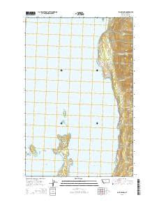
~ Bull Island MT topo map, 1:24000 scale, 7.5 X 7.5 Minute, Current, 2014
Bull Island, Montana, USGS topographic map dated 2014.
Includes geographic coordinates (latitude and longitude). This topographic map is suitable for hiking, camping, and exploring, or framing it as a wall map.
Printed on-demand using high resolution imagery, on heavy weight and acid free paper, or alternatively on a variety of synthetic materials.
Topos available on paper, Waterproof, Poly, or Tyvek. Usually shipping rolled, unless combined with other folded maps in one order.
- Product Number: USGS-7539774
- Free digital map download (high-resolution, GeoPDF): Bull Island, Montana (file size: 24 MB)
- Map Size: please refer to the dimensions of the GeoPDF map above
- Weight (paper map): ca. 55 grams
- Map Type: POD USGS Topographic Map
- Map Series: US Topo
- Map Verison: Current
- Cell ID: 6128
- Datum: North American Datum of 1983
- Map Projection: Transverse Mercator
- Map Cell Name: Bull Island
- Grid size: 7.5 X 7.5 Minute
- Date on map: 2014
- Map Scale: 1:24000
- Geographical region: Montana, United States
Neighboring Maps:
All neighboring USGS topo maps are available for sale online at a variety of scales.
Spatial coverage:
Topo map Bull Island, Montana, covers the geographical area associated the following places:
- Finley Point Campground - Station Creek - Boulder Creek - Blue Bay Creek - Bird Island - Finley Point - Yellow Bay - Teepee Creek - Dee Creek - Flathead Lake State Park - Finley Point Unit - Finley Point (historical) - Blue Bay - 23N19W07BAAA01 Well - Bull Island - 23N19W18BDAC01 Well - 23N19W07BDAC01 Well - 24N19W21ACAA01 Well - Skidoo Bay - Talking Water Creek - Sunset Bay - 23N19W18ABB_01 Well - Blue Bay (historical) - 24N19W16DCA_01 Well - The Narrows
- Map Area ID: AREA47.87547.75-114.125-114
- Northwest corner Lat/Long code: USGSNW47.875-114.125
- Northeast corner Lat/Long code: USGSNE47.875-114
- Southwest corner Lat/Long code: USGSSW47.75-114.125
- Southeast corner Lat/Long code: USGSSE47.75-114
- Northern map edge Latitude: 47.875
- Southern map edge Latitude: 47.75
- Western map edge Longitude: -114.125
- Eastern map edge Longitude: -114


