
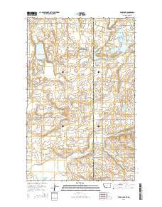
~ Brush Lake MT topo map, 1:24000 scale, 7.5 X 7.5 Minute, Current, 2014
Brush Lake, Montana, USGS topographic map dated 2014.
Includes geographic coordinates (latitude and longitude). This topographic map is suitable for hiking, camping, and exploring, or framing it as a wall map.
Printed on-demand using high resolution imagery, on heavy weight and acid free paper, or alternatively on a variety of synthetic materials.
Topos available on paper, Waterproof, Poly, or Tyvek. Usually shipping rolled, unless combined with other folded maps in one order.
- Product Number: USGS-7539718
- Free digital map download (high-resolution, GeoPDF): Brush Lake, Montana (file size: 26 MB)
- Map Size: please refer to the dimensions of the GeoPDF map above
- Weight (paper map): ca. 55 grams
- Map Type: POD USGS Topographic Map
- Map Series: US Topo
- Map Verison: Current
- Cell ID: 5814
- Datum: North American Datum of 1983
- Map Projection: Transverse Mercator
- Map Cell Name: Brush Lake
- Grid size: 7.5 X 7.5 Minute
- Date on map: 2014
- Map Scale: 1:24000
- Geographical region: Montana, United States
Neighboring Maps:
All neighboring USGS topo maps are available for sale online at a variety of scales.
Spatial coverage:
Topo map Brush Lake, Montana, covers the geographical area associated the following places:
- Brush Lake - 33N58E23CBCA02 Well - 33N58E36DDDD01 Well - 33N58E36AADD01 Well - 32N59E04DDDD01 Well - 32N59E09DDBC01 Well - 33N58E23CBCA01 Well - Stink Lake - 32N58E12DDCC01 Well - Township of Grenora - Saint Olaf Cemetery - 33N58E25AAAA02 Well - 33N58E23CCAA01 Well - 32N59E19BDBC01 Well - 32N58E13DDDB01 Well - 33N58E25AAAA03 Well - 33N58E25AAAA01 Well - 33N58E23AADB01 Well - Willow Creek - Twin Lakes - Wilson School - Horseshoe Lake - Liberty School - 32N59E29A___01 Well - LaFayette School (historical) - Brush Lake Resort - 32N59E08BCBA01 Well - 33N58E24AAAA01 Well
- Map Area ID: AREA48.62548.5-104.125-104
- Northwest corner Lat/Long code: USGSNW48.625-104.125
- Northeast corner Lat/Long code: USGSNE48.625-104
- Southwest corner Lat/Long code: USGSSW48.5-104.125
- Southeast corner Lat/Long code: USGSSE48.5-104
- Northern map edge Latitude: 48.625
- Southern map edge Latitude: 48.5
- Western map edge Longitude: -104.125
- Eastern map edge Longitude: -104


