
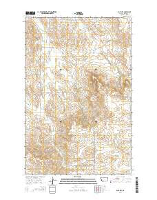
~ Blue Hill MT topo map, 1:24000 scale, 7.5 X 7.5 Minute, Current, 2014
Blue Hill, Montana, USGS topographic map dated 2014.
Includes geographic coordinates (latitude and longitude). This topographic map is suitable for hiking, camping, and exploring, or framing it as a wall map.
Printed on-demand using high resolution imagery, on heavy weight and acid free paper, or alternatively on a variety of synthetic materials.
Topos available on paper, Waterproof, Poly, or Tyvek. Usually shipping rolled, unless combined with other folded maps in one order.
- Product Number: USGS-7539102
- Free digital map download (high-resolution, GeoPDF): Blue Hill, Montana (file size: 27 MB)
- Map Size: please refer to the dimensions of the GeoPDF map above
- Weight (paper map): ca. 55 grams
- Map Type: POD USGS Topographic Map
- Map Series: US Topo
- Map Verison: Current
- Cell ID: 4502
- Datum: North American Datum of 1983
- Map Projection: Transverse Mercator
- Map Cell Name: Blue Hill
- Grid size: 7.5 X 7.5 Minute
- Date on map: 2014
- Map Scale: 1:24000
- Geographical region: Montana, United States
Neighboring Maps:
All neighboring USGS topo maps are available for sale online at a variety of scales.
Spatial coverage:
Topo map Blue Hill, Montana, covers the geographical area associated the following places:
- Nile Post Office (historical) - Cherry Creek Church - Buckley Dam - Buckley Creek - Palmers Creek - Cherry Coulee - 25N57E29AAAD01 Well - 25N57E08AAC_01 Well - Cherry Creek School - Doran School - Blue Hill - Arthur Dam - Wick Landing Strip (historical) - Lone Butte - T Hackley Number 1 Dam - Antelope Creek - Cherry Creek Cemetery - 25N56E11BAAB01 Well - Lone Butte Cemetery - 26N56E24DACA01 Well - Glendenning School (historical)
- Map Area ID: AREA4847.875-104.5-104.375
- Northwest corner Lat/Long code: USGSNW48-104.5
- Northeast corner Lat/Long code: USGSNE48-104.375
- Southwest corner Lat/Long code: USGSSW47.875-104.5
- Southeast corner Lat/Long code: USGSSE47.875-104.375
- Northern map edge Latitude: 48
- Southern map edge Latitude: 47.875
- Western map edge Longitude: -104.5
- Eastern map edge Longitude: -104.375


