
~ Birney SW MT topo map, 1:24000 scale, 7.5 X 7.5 Minute, Current, 2014
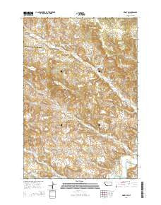
Birney SW, Montana, USGS topographic map dated 2014.
Includes geographic coordinates (latitude and longitude). This topographic map is suitable for hiking, camping, and exploring, or framing it as a wall map.
Printed on-demand using high resolution imagery, on heavy weight and acid free paper, or alternatively on a variety of synthetic materials.
Topos available on paper, Waterproof, Poly, or Tyvek. Usually shipping rolled, unless combined with other folded maps in one order.
- Product Number: USGS-7538920
- Free digital map download (high-resolution, GeoPDF): Birney SW, Montana (file size: 36 MB)
- Map Size: please refer to the dimensions of the GeoPDF map above
- Weight (paper map): ca. 55 grams
- Map Type: POD USGS Topographic Map
- Map Series: US Topo
- Map Verison: Current
- Cell ID: 4007
- Datum: North American Datum of 1983
- Map Projection: Transverse Mercator
- Map Cell Name: Birney SW
- Grid size: 7.5 X 7.5 Minute
- Date on map: 2014
- Map Scale: 1:24000
- Geographical region: Montana, United States
Neighboring Maps:
All neighboring USGS topo maps are available for sale online at a variety of scales.
Spatial coverage:
Topo map Birney SW, Montana, covers the geographical area associated the following places:
- 07S41E02AACC01 Spring - 06S41E21ADBD02 Well - 05S41E31CBBC01 Spring - 05S41E31DDDA01 Spring - 06S41E17ADDD01 Well - 06S41E32CADA01 Well - South Fork Canyon Creek - 06S41E34CDAA02 Well - 06S41E02ACCB01 Spring - 06S41E21ADBD01 Well - 06S42E31DBBD01 Well - 06S41E08CCAC01 Well - 05S41E31AAAA01 Spring - 06S41E11AAAA01 Spring - 06S41E21DDDC01 Well - 06S41E22CABC01 Well - 06S41E15DCDA01 Well - Jeffrys Prong - North Fork Canyon Creek - 06S41E33BBBD02 Well - 05S41E35CBCC01 Spring - 06S41E22CABD01 Well - 06S41E26BACC01 Well - 06S41E26BBDA01 Well - 06S41E33BBBD01 Well - 06S41E08CCBA01 Well - 06S41E08CCBD01 Well - 06S41E25CDAC01 Well - 05S41E30CCBB01 Spring - 06S42E31DBBA02 Well - Spring Creek - 06S41E12BBAC01 Spring - 06S41E21BBCD01 Well - Schoolhouse Draw - 06S41E22CDCB01 Well - 06S41E01DBCB01 Spring - 05S41E32CDBC01 Spring - 06S41E23CCCC01 Well - 06S42E31DBBA01 Well - Four D Ditch - 4 D School (historical) - 06S41E29ADCA01 Well - 06S41E17DAAA02 Well - 06S41E17ADDD02 Well - Jack Creek - Four D Ranch - 06S41E17DAAA01 Well - 06S41E29ADCA02 Well - 06S41E26BBDC01 Well - 06S41E26BBDD01 Well - 06S41E25CBDD01 Spring - 06S41E21ADBA01 Well - 06S41E12BDBD01 Spring - South Fork Bull Creek - 07S42E06BCAA01 Well - 06S41E29BACB01 Spring - 06S41E26BBDA02 Well - 06S41E22CACB01 Well - 05S41E28DDDC01 Spring - Brewster Camp - 06S41E16BBCC01 Well - 06S41E34CDAA01 Well - Ted Flat - 06S42E19CDBC01 Well - 06S41E03BADD01 Well - 07S41E04DCDD01 Well - 07S42E06BCDB01 Well - 07S42E06B___01 Well - 06S41E03BBDD01 Well - 06S41E03BADD02 Well - 06S41E25CCBB01 Well - Coyote Creek - 05S41E31CBAC01 Well - Bootlegger Draw
- Map Area ID: AREA45.37545.25-106.75-106.625
- Northwest corner Lat/Long code: USGSNW45.375-106.75
- Northeast corner Lat/Long code: USGSNE45.375-106.625
- Southwest corner Lat/Long code: USGSSW45.25-106.75
- Southeast corner Lat/Long code: USGSSE45.25-106.625
- Northern map edge Latitude: 45.375
- Southern map edge Latitude: 45.25
- Western map edge Longitude: -106.75
- Eastern map edge Longitude: -106.625


