
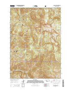
~ Ash Mountain MT topo map, 1:24000 scale, 7.5 X 7.5 Minute, Current, 2014
Ash Mountain, Montana, USGS topographic map dated 2014.
Includes geographic coordinates (latitude and longitude). This topographic map is suitable for hiking, camping, and exploring, or framing it as a wall map.
Printed on-demand using high resolution imagery, on heavy weight and acid free paper, or alternatively on a variety of synthetic materials.
Topos available on paper, Waterproof, Poly, or Tyvek. Usually shipping rolled, unless combined with other folded maps in one order.
- Product Number: USGS-7538280
- Free digital map download (high-resolution, GeoPDF): Ash Mountain, Montana (file size: 37 MB)
- Map Size: please refer to the dimensions of the GeoPDF map above
- Weight (paper map): ca. 55 grams
- Map Type: POD USGS Topographic Map
- Map Series: US Topo
- Map Verison: Current
- Cell ID: 1616
- Datum: North American Datum of 1983
- Map Projection: Transverse Mercator
- Map Cell Name: Ash Mountain
- Grid size: 7.5 X 7.5 Minute
- Date on map: 2014
- Map Scale: 1:24000
- Geographical region: Montana, United States
Neighboring Maps:
All neighboring USGS topo maps are available for sale online at a variety of scales.
Spatial coverage:
Topo map Ash Mountain, Montana, covers the geographical area associated the following places:
- Conrad 2 Mine - First Chance/Lower Mine - Snowshoe Mine - Ash Mountain - Fawn Lake - Ash Mountain Trail - Homestead Mine - Conrad 3 Mine - West Fork Crevice Creek - Knowles Falls - B S Tunnel Mine - Jardine Census Designated Place - Bald Mountain - Pratt Mine - Spotted Horse Mine - Vista Mine - Sin Nombre Mine - NW Section 14 Mine - Kennebeck Mine - Rio Grande Mine - Bonanza/Kentuck Mine - George Mine - Crevice Station - Conrad 6 Mine - M Tunnel Mine - Columbia Mine - Buffalo Mountain - Darroch Creek - Conrad Incline Mine - Summit Mine - Topeka Mine - Charlie White Lake - Vindicator Mine - Bald Mountain Mine - Tower Grove Mine - NW Section 22 Mine - Crevasse Post Office (historical) - Conrad Mine - Palmer Mountain - First Chance Mine - Crevice Creek - Jupiter Mine - Jardine Cemetery - Mineral Hill - Clark Mine - J Tunnel Mine - Medona Mine - Pop Incline Mine - Little Bonanza Mine - Medona North Mine - Yellowstone National Park Division - Yale-McGinty Mine - McCauley South Mine - SE Section 14 Mine - Emma Mine - Crevice Lake - Helldorado Mine - Guest Tunnel Mine - Empire State Mine - Vista 3 Mine - Oregon Mountain - Granite Mine - Crevice Mountain - Jones Cabin Mine - Watson Mine - Jardine-Hellroaring Trail
- Map Area ID: AREA45.12545-110.625-110.5
- Northwest corner Lat/Long code: USGSNW45.125-110.625
- Northeast corner Lat/Long code: USGSNE45.125-110.5
- Southwest corner Lat/Long code: USGSSW45-110.625
- Southeast corner Lat/Long code: USGSSE45-110.5
- Northern map edge Latitude: 45.125
- Southern map edge Latitude: 45
- Western map edge Longitude: -110.625
- Eastern map edge Longitude: -110.5


