
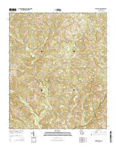
~ Warthen NW GA topo map, 1:24000 scale, 7.5 X 7.5 Minute, Current, 2014
Warthen NW, Georgia, USGS topographic map dated 2014.
Includes geographic coordinates (latitude and longitude). This topographic map is suitable for hiking, camping, and exploring, or framing it as a wall map.
Printed on-demand using high resolution imagery, on heavy weight and acid free paper, or alternatively on a variety of synthetic materials.
Topos available on paper, Waterproof, Poly, or Tyvek. Usually shipping rolled, unless combined with other folded maps in one order.
- Product Number: USGS-7537517
- Free digital map download (high-resolution, GeoPDF): Warthen NW, Georgia (file size: 39 MB)
- Map Size: please refer to the dimensions of the GeoPDF map above
- Weight (paper map): ca. 55 grams
- Map Type: POD USGS Topographic Map
- Map Series: US Topo
- Map Verison: Current
- Cell ID: 71986
- Datum: North American Datum of 1983
- Map Projection: Transverse Mercator
- Map Cell Name: Warthen NW
- Grid size: 7.5 X 7.5 Minute
- Date on map: 2014
- Map Scale: 1:24000
- Geographical region: Georgia, United States
Neighboring Maps:
All neighboring USGS topo maps are available for sale online at a variety of scales.
Spatial coverage:
Topo map Warthen NW, Georgia, covers the geographical area associated the following places:
- Garland Family Cemetery - Smith Cemetery - Archer Grove Church Cemetery - Little Buffalo Creek - Lunsford-Wall-Sisson Family Cemetery - Shivers Mission Cemetery - Browns Chapel African Methodist Episcopal Cemetery - Hancock State Prison - Frasier Cemetery - Hopewell School (historical) - Union Cemetery - Nazareth Church Cemetery - N F Garland Gravesite - Gilmore Family Cemetery - Bailey Family Cemetery - Mount Hope Church - Hopewell Church - Archer Grove Church - Union Church - Knowles Chapel Cemetery - Pinkston Creek - Barnes Family Cemetery - Knowles Chapel - Ozborn Cemetery - Mount Hope Church Cemetery - Sandy Run Creek - Dickson Cemetery - Balerma Cemetery - Galillee School - Shiver Grove Church - Zebulon Methodist Church - Carr Family Cemetery - Zebulon Methodist Church Cemetery - Sandy Run Church - Balerma Church - Dickson Cemetery Number 2 - Rocky Creek
- Map Area ID: AREA33.2533.125-83-82.875
- Northwest corner Lat/Long code: USGSNW33.25-83
- Northeast corner Lat/Long code: USGSNE33.25-82.875
- Southwest corner Lat/Long code: USGSSW33.125-83
- Southeast corner Lat/Long code: USGSSE33.125-82.875
- Northern map edge Latitude: 33.25
- Southern map edge Latitude: 33.125
- Western map edge Longitude: -83
- Eastern map edge Longitude: -82.875


