
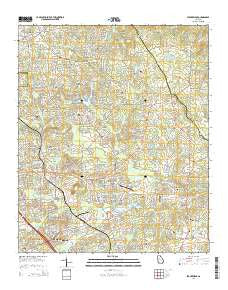
~ Stockbridge GA topo map, 1:24000 scale, 7.5 X 7.5 Minute, Current, 2014
Stockbridge, Georgia, USGS topographic map dated 2014.
Includes geographic coordinates (latitude and longitude). This topographic map is suitable for hiking, camping, and exploring, or framing it as a wall map.
Printed on-demand using high resolution imagery, on heavy weight and acid free paper, or alternatively on a variety of synthetic materials.
Topos available on paper, Waterproof, Poly, or Tyvek. Usually shipping rolled, unless combined with other folded maps in one order.
- Product Number: USGS-7536935
- Free digital map download (high-resolution, GeoPDF): Stockbridge, Georgia (file size: 35 MB)
- Map Size: please refer to the dimensions of the GeoPDF map above
- Weight (paper map): ca. 55 grams
- Map Type: POD USGS Topographic Map
- Map Series: US Topo
- Map Verison: Current
- Cell ID: 43250
- Datum: North American Datum of 1983
- Map Projection: Transverse Mercator
- Map Cell Name: Stockbridge
- Grid size: 7.5 X 7.5 Minute
- Date on map: 2014
- Map Scale: 1:24000
- Geographical region: Georgia, United States
Neighboring Maps:
All neighboring USGS topo maps are available for sale online at a variety of scales.
Spatial coverage:
Topo map Stockbridge, Georgia, covers the geographical area associated the following places:
- Martin Creek Country Estates - Millers Mill - Knob (historical) - Stokes Crossing - Oakhill - Mahers (historical) - Fay (historical) - Fairview Manor - Cotton Indian Creek - Woodhaven Estates - Chimney Ridge - Fairview Station - Belair Woods - Springfield Acres - Pinecrest - Autumn Chase - Stockbridge North - Patillo Point - Highland Village - Whitehouse - Brownwood Acres - Oakwood Manor - Belmount Farms - Southbridge - Dove Rest - Bridgewood - Fairfield Glen - Country Roads - Flintlook - Swan Lake - Tunis (historical) - Hidden Valley - Brannan - Flakes Crossing - Carriage Trace - Pinehurst - Ridgecrest - Colonial Coach Estates - Brownwood - Duval - Springwood Valley - Stockbridge - Hidden Lakes - Pine Valley Estates - Club Drive - Circle Creek - Parkwood - Richardson
- Map Area ID: AREA33.62533.5-84.25-84.125
- Northwest corner Lat/Long code: USGSNW33.625-84.25
- Northeast corner Lat/Long code: USGSNE33.625-84.125
- Southwest corner Lat/Long code: USGSSW33.5-84.25
- Southeast corner Lat/Long code: USGSSE33.5-84.125
- Northern map edge Latitude: 33.625
- Southern map edge Latitude: 33.5
- Western map edge Longitude: -84.25
- Eastern map edge Longitude: -84.125


