
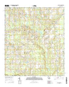
~ Sapps Lake GA topo map, 1:24000 scale, 7.5 X 7.5 Minute, Current, 2014
Sapps Lake, Georgia, USGS topographic map dated 2014.
Includes geographic coordinates (latitude and longitude). This topographic map is suitable for hiking, camping, and exploring, or framing it as a wall map.
Printed on-demand using high resolution imagery, on heavy weight and acid free paper, or alternatively on a variety of synthetic materials.
Topos available on paper, Waterproof, Poly, or Tyvek. Usually shipping rolled, unless combined with other folded maps in one order.
- Product Number: USGS-7536815
- Free digital map download (high-resolution, GeoPDF): Sapps Lake, Georgia (file size: 33 MB)
- Map Size: please refer to the dimensions of the GeoPDF map above
- Weight (paper map): ca. 55 grams
- Map Type: POD USGS Topographic Map
- Map Series: US Topo
- Map Verison: Current
- Cell ID: 39954
- Datum: North American Datum of 1983
- Map Projection: Transverse Mercator
- Map Cell Name: Sapps Lake
- Grid size: 7.5 X 7.5 Minute
- Date on map: 2014
- Map Scale: 1:24000
- Geographical region: Georgia, United States
Neighboring Maps:
All neighboring USGS topo maps are available for sale online at a variety of scales.
Spatial coverage:
Topo map Sapps Lake, Georgia, covers the geographical area associated the following places:
- Liberty Church - Vickers Church - Pleasant Hill Church - West Berrien School - Lindsey Lake Dam - Lindsey Lake - Cypress Creek - Gum Branch - Hog Creek - McMillian Lake Dam - Flat Creek Church - Gaskins Lake - McMillian Lake - Flat Creek Cemetery - Gainey Bridge - Enigma Division - Sapps Lake - Gaskins Lake Dam - Sapps Lake Dam - Flat Creek - Emmaus Primitive Baptist Church (historical) - Ebenezer Church - Poley Branch - Pine Ridge Church - McMillian Lake - West Berrien Volunteer Fire Department - Hardy Mill Creek - Vickers School (historical) - McMillian Lake Dam - Vickers Cemetery - Parkers Chapel
- Map Area ID: AREA31.37531.25-83.375-83.25
- Northwest corner Lat/Long code: USGSNW31.375-83.375
- Northeast corner Lat/Long code: USGSNE31.375-83.25
- Southwest corner Lat/Long code: USGSSW31.25-83.375
- Southeast corner Lat/Long code: USGSSE31.25-83.25
- Northern map edge Latitude: 31.375
- Southern map edge Latitude: 31.25
- Western map edge Longitude: -83.375
- Eastern map edge Longitude: -83.25


