
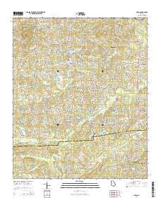
~ Nebo GA topo map, 1:24000 scale, 7.5 X 7.5 Minute, Current, 2014
Nebo, Georgia, USGS topographic map dated 2014.
Includes geographic coordinates (latitude and longitude). This topographic map is suitable for hiking, camping, and exploring, or framing it as a wall map.
Printed on-demand using high resolution imagery, on heavy weight and acid free paper, or alternatively on a variety of synthetic materials.
Topos available on paper, Waterproof, Poly, or Tyvek. Usually shipping rolled, unless combined with other folded maps in one order.
- Product Number: USGS-7536411
- Free digital map download (high-resolution, GeoPDF): Nebo, Georgia (file size: 38 MB)
- Map Size: please refer to the dimensions of the GeoPDF map above
- Weight (paper map): ca. 55 grams
- Map Type: POD USGS Topographic Map
- Map Series: US Topo
- Map Verison: Current
- Cell ID: 31449
- Datum: North American Datum of 1983
- Map Projection: Transverse Mercator
- Map Cell Name: Nebo
- Grid size: 7.5 X 7.5 Minute
- Date on map: 2014
- Map Scale: 1:24000
- Geographical region: Georgia, United States
Neighboring Maps:
All neighboring USGS topo maps are available for sale online at a variety of scales.
Spatial coverage:
Topo map Nebo, Georgia, covers the geographical area associated the following places:
- Pilgrim North - Lincoln Heights - Hartfield Acres - Baldwin Hills - Nebo Place - Campground School Estates - Old Davis Mill Estates - Ridge Corners - Ridgeview Heights - Bromley Estates - Fleetwood Hills - Mountainview Estates - Nebo - Nebo Gardens - Ash - The Highlands - South Paulding Woods - Hollyberry - Hartfield Estates - Quail Run - Lake Swan - Corn Crib Mobile Home Park - Paces Lakes - Ashley Acres - Paces Meadows - Deer Run - Denton Farms - The South Forty - Country Club Estates - Bakers Bridge Estates - Home Place Acres - Victoria Cove - Mill Creek Place - Green Meadows - Westwood Heights - Honeysuckle Plantation - Oberlochen - Brownsville - Sudie - Swan Lake - Denton Estates - Oak Creek - Quail Run East - Asbury Woods - Black Forest - Joseph Estates - Pine Forest - Emerald Forest - Sweetwater Estates - Meadowbrook - Spring Ridge Estates - Colonial Hills - Sprayberry Farms - Greenfield Summit - Arbor Walk - Gordon Estates
- Map Area ID: AREA33.87533.75-84.875-84.75
- Northwest corner Lat/Long code: USGSNW33.875-84.875
- Northeast corner Lat/Long code: USGSNE33.875-84.75
- Southwest corner Lat/Long code: USGSSW33.75-84.875
- Southeast corner Lat/Long code: USGSSE33.75-84.75
- Northern map edge Latitude: 33.875
- Southern map edge Latitude: 33.75
- Western map edge Longitude: -84.875
- Eastern map edge Longitude: -84.75


