
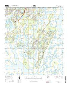
~ Isle of Hope GA topo map, 1:24000 scale, 7.5 X 7.5 Minute, Current, 2014
Isle of Hope, Georgia, USGS topographic map dated 2014.
Includes geographic coordinates (latitude and longitude). This topographic map is suitable for hiking, camping, and exploring, or framing it as a wall map.
Printed on-demand using high resolution imagery, on heavy weight and acid free paper, or alternatively on a variety of synthetic materials.
Topos available on paper, Waterproof, Poly, or Tyvek. Usually shipping rolled, unless combined with other folded maps in one order.
- Product Number: USGS-7536135
- Free digital map download (high-resolution, GeoPDF): Isle of Hope, Georgia (file size: 29 MB)
- Map Size: please refer to the dimensions of the GeoPDF map above
- Weight (paper map): ca. 55 grams
- Map Type: POD USGS Topographic Map
- Map Series: US Topo
- Map Verison: Current
- Cell ID: 22167
- Datum: North American Datum of 1983
- Map Projection: Transverse Mercator
- Map Cell Name: Isle of Hope
- Grid size: 7.5 X 7.5 Minute
- Date on map: 2014
- Map Scale: 1:24000
- Geographical region: Georgia, United States
Neighboring Maps:
All neighboring USGS topo maps are available for sale online at a variety of scales.
Spatial coverage:
Topo map Isle of Hope, Georgia, covers the geographical area associated the following places:
- Halcyon Bluff - Wymberly - Vernonburg - Bakers Crossing - Wymberly on the Marsh - Oakhurst - Montgomery - Lakeside Park - Vernon View - Skidaway Island - Grimball Park - Lynhurst - Kings Wood - Beaulieu - Parkersburg - Cedar Hammock - The Landings - Bethesda - Harrock Hall - Marshwood at the Landings - Pin Point - Rio Vista - Sandfly - Waters Bluff Mobile Home Park - Isle of Hope - Wormsloe - Burnside - Rivers End - Mayfair - Rose Hill - Chippewa Terrace - Burnside View - Grove Park - Cresthill
- Map Area ID: AREA3231.875-81.125-81
- Northwest corner Lat/Long code: USGSNW32-81.125
- Northeast corner Lat/Long code: USGSNE32-81
- Southwest corner Lat/Long code: USGSSW31.875-81.125
- Southeast corner Lat/Long code: USGSSE31.875-81
- Northern map edge Latitude: 32
- Southern map edge Latitude: 31.875
- Western map edge Longitude: -81.125
- Eastern map edge Longitude: -81


