
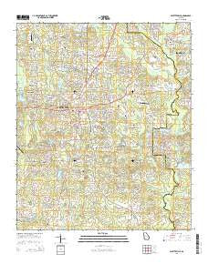
~ Fayetteville GA topo map, 1:24000 scale, 7.5 X 7.5 Minute, Current, 2014
Fayetteville, Georgia, USGS topographic map dated 2014.
Includes geographic coordinates (latitude and longitude). This topographic map is suitable for hiking, camping, and exploring, or framing it as a wall map.
Printed on-demand using high resolution imagery, on heavy weight and acid free paper, or alternatively on a variety of synthetic materials.
Topos available on paper, Waterproof, Poly, or Tyvek. Usually shipping rolled, unless combined with other folded maps in one order.
- Product Number: USGS-7535603
- Free digital map download (high-resolution, GeoPDF): Fayetteville, Georgia (file size: 34 MB)
- Map Size: please refer to the dimensions of the GeoPDF map above
- Weight (paper map): ca. 55 grams
- Map Type: POD USGS Topographic Map
- Map Series: US Topo
- Map Verison: Current
- Cell ID: 15104
- Datum: North American Datum of 1983
- Map Projection: Transverse Mercator
- Map Cell Name: Fayetteville
- Grid size: 7.5 X 7.5 Minute
- Date on map: 2014
- Map Scale: 1:24000
- Geographical region: Georgia, United States
Neighboring Maps:
All neighboring USGS topo maps are available for sale online at a variety of scales.
Spatial coverage:
Topo map Fayetteville, Georgia, covers the geographical area associated the following places:
- Windsor Estates - Forest Hills - Gregory Estates - Fernway Estates - Ponderosa - Winterthur Woods - Chandler Acres - Rolling Meadows Estates - McIntosh Village - Greenlea - Fenwyck - Ginger Hills - Blakely Woods - Beverly Manor - Keyland Woods - Medford Manor - Shannon - Mitchell Estates - Huntington Creek - Briarwood Park - Cottonwood - Marilyn Acres - Deep Forest - Fayetteville - Sharon Heights - Forest Estates - Fayette Acres - Coventry Estates - Deer Glen Forest - Brookcliff - Rest (historical) - Cross Creek - Harp - Hickory Acres - Inman - Marion - Mundys Mill - Quail Hollow - Kingswood - Calebs Meadows - Oak Hills - Huntington South - Chanticleer - Tunis Trace - Lakeview Estates - Wellington Manor - Whipporwill Ridge
- Map Area ID: AREA33.533.375-84.5-84.375
- Northwest corner Lat/Long code: USGSNW33.5-84.5
- Northeast corner Lat/Long code: USGSNE33.5-84.375
- Southwest corner Lat/Long code: USGSSW33.375-84.5
- Southeast corner Lat/Long code: USGSSE33.375-84.375
- Northern map edge Latitude: 33.5
- Southern map edge Latitude: 33.375
- Western map edge Longitude: -84.5
- Eastern map edge Longitude: -84.375


