
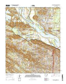
~ Pinnacle Mountain AR topo map, 1:24000 scale, 7.5 X 7.5 Minute, Current, 2014
Pinnacle Mountain, Arkansas, USGS topographic map dated 2014.
Includes geographic coordinates (latitude and longitude). This topographic map is suitable for hiking, camping, and exploring, or framing it as a wall map.
Printed on-demand using high resolution imagery, on heavy weight and acid free paper, or alternatively on a variety of synthetic materials.
Topos available on paper, Waterproof, Poly, or Tyvek. Usually shipping rolled, unless combined with other folded maps in one order.
- Product Number: USGS-7483639
- Free digital map download (high-resolution, GeoPDF): Pinnacle Mountain, Arkansas (file size: 41 MB)
- Map Size: please refer to the dimensions of the GeoPDF map above
- Weight (paper map): ca. 55 grams
- Map Type: POD USGS Topographic Map
- Map Series: US Topo
- Map Verison: Current
- Cell ID: 35372
- Datum: North American Datum of 1983
- Map Projection: Transverse Mercator
- Map Cell Name: Pinnacle Mountain
- Grid size: 7.5 X 7.5 Minute
- Date on map: 2014
- Map Scale: 1:24000
- Geographical region: Arkansas, United States
Neighboring Maps:
All neighboring USGS topo maps are available for sale online at a variety of scales.
Spatial coverage:
Topo map Pinnacle Mountain, Arkansas, covers the geographical area associated the following places:
- Ivesville - Hickory Hills - Pleasant Forest - Maumelle - Pleasant Valley Estates - Woodland Hills - Mesa View - Turtle Creek - Pankey - Candlewood - River Ridge Manor - Woodland Heights - Parkway Place - Walton Heights - Breckenridge - Longlea - Colony West - Maumelle Station - Shady Grove - Pleasant Valley - Saint Thomas - Pleasant View - Natural Steps - Rock Creek - Saint Charles - Pinnacle - Piedmont - Hillsborough - Hickory Ridge - Secluded Hills - Rainwood - Pebble Beach Park - Pleasant Ridge
- Map Area ID: AREA34.87534.75-92.5-92.375
- Northwest corner Lat/Long code: USGSNW34.875-92.5
- Northeast corner Lat/Long code: USGSNE34.875-92.375
- Southwest corner Lat/Long code: USGSSW34.75-92.5
- Southeast corner Lat/Long code: USGSSE34.75-92.375
- Northern map edge Latitude: 34.875
- Southern map edge Latitude: 34.75
- Western map edge Longitude: -92.5
- Eastern map edge Longitude: -92.375


