
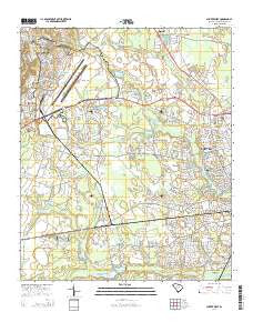
~ Sumter West SC topo map, 1:24000 scale, 7.5 X 7.5 Minute, Current, 2014
Sumter West, South Carolina, USGS topographic map dated 2014.
Includes geographic coordinates (latitude and longitude). This topographic map is suitable for hiking, camping, and exploring, or framing it as a wall map.
Printed on-demand using high resolution imagery, on heavy weight and acid free paper, or alternatively on a variety of synthetic materials.
Topos available on paper, Waterproof, Poly, or Tyvek. Usually shipping rolled, unless combined with other folded maps in one order.
- Product Number: USGS-7477935
- Free digital map download (high-resolution, GeoPDF): Sumter West, South Carolina (file size: 36 MB)
- Map Size: please refer to the dimensions of the GeoPDF map above
- Weight (paper map): ca. 55 grams
- Map Type: POD USGS Topographic Map
- Map Series: US Topo
- Map Verison: Current
- Cell ID: 43776
- Datum: North American Datum of 1983
- Map Projection: Transverse Mercator
- Map Cell Name: Sumter West
- Grid size: 7.5 X 7.5 Minute
- Date on map: 2014
- Map Scale: 1:24000
- Geographical region: South Carolina, United States
Neighboring Maps:
All neighboring USGS topo maps are available for sale online at a variety of scales.
Spatial coverage:
Topo map Sumter West, South Carolina, covers the geographical area associated the following places:
- Bon Air Terrace - West Ridge - Oak Haven Acres - Millwood Gardens - Twin Lakes - Cherryvale - Swinton - Warwick Estates - Windsor City Mobile Home Park - East Sunway Knolls - Hearthstone - Sellars Heights - Bay Springs - Azalea Trailer Park - Summer View - Wedgewood Grove - General Sumter Estates - Bradford - Winter Park - Home Acres - Park West - Millwood - Edgewater - Deerfield - Beckridge Park - Westhaven - Oakland - Beckwood - Cane Savannah - Rainbow Falls - Ashley Creek Village - The Village Subdivision - North Deerfield - Avondale - Austin Acres - Shaw Heights - Marden Ranchettes - Cartley Subdivision - Idlewood - Spring Lake - Pinckney Crossroad - Sunset Homes - Shady Grove - Causeway Branch - Audubon Park - Carolina Mobile Home Park - Curtis Park - Hilldale - Sunway Knolls - Dinkins - Sanders Subdivision
- Map Area ID: AREA3433.875-80.5-80.375
- Northwest corner Lat/Long code: USGSNW34-80.5
- Northeast corner Lat/Long code: USGSNE34-80.375
- Southwest corner Lat/Long code: USGSSW33.875-80.5
- Southeast corner Lat/Long code: USGSSE33.875-80.375
- Northern map edge Latitude: 34
- Southern map edge Latitude: 33.875
- Western map edge Longitude: -80.5
- Eastern map edge Longitude: -80.375


