
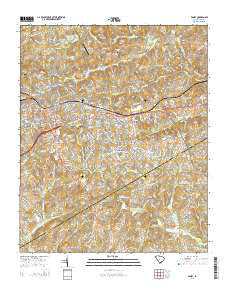
~ Easley SC topo map, 1:24000 scale, 7.5 X 7.5 Minute, Current, 2014
Easley, South Carolina, USGS topographic map dated 2014.
Includes geographic coordinates (latitude and longitude). This topographic map is suitable for hiking, camping, and exploring, or framing it as a wall map.
Printed on-demand using high resolution imagery, on heavy weight and acid free paper, or alternatively on a variety of synthetic materials.
Topos available on paper, Waterproof, Poly, or Tyvek. Usually shipping rolled, unless combined with other folded maps in one order.
- Product Number: USGS-7469073
- Free digital map download (high-resolution, GeoPDF): Easley, South Carolina (file size: 43 MB)
- Map Size: please refer to the dimensions of the GeoPDF map above
- Weight (paper map): ca. 55 grams
- Map Type: POD USGS Topographic Map
- Map Series: US Topo
- Map Verison: Current
- Cell ID: 13325
- Datum: North American Datum of 1983
- Map Projection: Transverse Mercator
- Map Cell Name: Easley
- Grid size: 7.5 X 7.5 Minute
- Date on map: 2014
- Map Scale: 1:24000
- Geographical region: South Carolina, United States
Neighboring Maps:
All neighboring USGS topo maps are available for sale online at a variety of scales.
Spatial coverage:
Topo map Easley, South Carolina, covers the geographical area associated the following places:
- North Hills - Countryside Manor - Heathwood - Forest Acres - Burdine Springs - Botany Park - Chadwick - Timberlane - Briargate - Easley - Longcreek - Glenwood - Vista Heights - Yorkwood - Kingsberry - Holly Hill - Hamilton Heights - Huntington North - Monte Vista - Wyatt Acres - Smithfields - Marshall Heights - Avondale Heights - Oak Creek - Brookwood Heights - Georgetown - Crestview Heights - Elaine Heights - McDaniel Heights - Montague - Shoals Creek Subdivision - Perry Hills - Forest Park - Lathem - Springdale - Cherokee Forest - Canaan Land - Huntington South - Twinbrook - Pageland - Pickensville - Hale
- Map Area ID: AREA34.87534.75-82.625-82.5
- Northwest corner Lat/Long code: USGSNW34.875-82.625
- Northeast corner Lat/Long code: USGSNE34.875-82.5
- Southwest corner Lat/Long code: USGSSW34.75-82.625
- Southeast corner Lat/Long code: USGSSE34.75-82.5
- Northern map edge Latitude: 34.875
- Southern map edge Latitude: 34.75
- Western map edge Longitude: -82.625
- Eastern map edge Longitude: -82.5


