
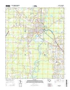
~ Conway SC topo map, 1:24000 scale, 7.5 X 7.5 Minute, Current, 2014
Conway, South Carolina, USGS topographic map dated 2014.
Includes geographic coordinates (latitude and longitude). This topographic map is suitable for hiking, camping, and exploring, or framing it as a wall map.
Printed on-demand using high resolution imagery, on heavy weight and acid free paper, or alternatively on a variety of synthetic materials.
Topos available on paper, Waterproof, Poly, or Tyvek. Usually shipping rolled, unless combined with other folded maps in one order.
- Product Number: USGS-7468880
- Free digital map download (high-resolution, GeoPDF): Conway, South Carolina (file size: 35 MB)
- Map Size: please refer to the dimensions of the GeoPDF map above
- Weight (paper map): ca. 55 grams
- Map Type: POD USGS Topographic Map
- Map Series: US Topo
- Map Verison: Current
- Cell ID: 9923
- Datum: North American Datum of 1983
- Map Projection: Transverse Mercator
- Map Cell Name: Conway
- Grid size: 7.5 X 7.5 Minute
- Date on map: 2014
- Map Scale: 1:24000
- Geographical region: South Carolina, United States
Neighboring Maps:
All neighboring USGS topo maps are available for sale online at a variety of scales.
Spatial coverage:
Topo map Conway, South Carolina, covers the geographical area associated the following places:
- Chicora - Whittemore Park - Greenbriar - Darden Terrace - Buckwood - Mary - El Bethel - Pitch Landing - North Conway - Country Club Forest - Cochran Town - Grissett - Coastal Heights - Conway - Toddville - Pine Valley Estates - University Forest - Cedar Grove - Pinewood - College Park - Quattlebaum Acres - Wilson Landing - Park Hill - Huckabee Heights - Crosswinds - Longwood - White Oak - Jamestown - Sand Ridge - Red Hill - Burning Ridge
- Map Area ID: AREA33.87533.75-79.125-79
- Northwest corner Lat/Long code: USGSNW33.875-79.125
- Northeast corner Lat/Long code: USGSNE33.875-79
- Southwest corner Lat/Long code: USGSSW33.75-79.125
- Southeast corner Lat/Long code: USGSSE33.75-79
- Northern map edge Latitude: 33.875
- Southern map edge Latitude: 33.75
- Western map edge Longitude: -79.125
- Eastern map edge Longitude: -79


