
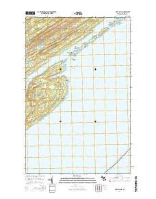
~ Mott Island MI topo map, 1:24000 scale, 7.5 X 7.5 Minute, Historical, 2014
Mott Island, Michigan, USGS topographic map dated 2014.
Includes geographic coordinates (latitude and longitude). This topographic map is suitable for hiking, camping, and exploring, or framing it as a wall map.
Printed on-demand using high resolution imagery, on heavy weight and acid free paper, or alternatively on a variety of synthetic materials.
Topos available on paper, Waterproof, Poly, or Tyvek. Usually shipping rolled, unless combined with other folded maps in one order.
- Product Number: USGS-7265654
- Free digital map download (high-resolution, GeoPDF): Mott Island, Michigan (file size: 29 MB)
- Map Size: please refer to the dimensions of the GeoPDF map above
- Weight (paper map): ca. 55 grams
- Map Type: POD USGS Topographic Map
- Map Series: US Topo
- Map Verison: Historical
- Cell ID: 30408
- Datum: North American Datum of 1983
- Map Projection: Transverse Mercator
- Map Cell Name: Mott Island
- Grid size: 7.5 X 7.5 Minute
- Date on map: 2014
- Map Scale: 1:24000
- Geographical region: Michigan, United States
Neighboring Maps:
All neighboring USGS topo maps are available for sale online at a variety of scales.
Spatial coverage:
Topo map Mott Island, Michigan, covers the geographical area associated the following places:
- Mott Island - Mount Ojibway Trail - Forbes Lake - Middle Islands Passage - Threemile Campground - Saginaw Point - Mount Ojibway - Lea Cove - Rock Harbor Trail - Dollar Bay - Ransom Mine - Indian Head Point - Lorelei Lane - Cemetery Island - Sumner Lake - Baker Point - Siskowit Mine - Inner Hill Island - Starvation Point - Burnt Island - Daisy Farm Campground - Daisy Farm Trail - Conglomerate Bay - Township of Houghton - Star Island - Outer Hill Island - East Caribou Island - Davidson Island - Saginaw Mine - Rock Harbor - Lake John - Benson Creek - Epidote Lake - Newt Lake - Mad Island - Caribou Arch - Ransom Hill - Epidote Mine - West Caribou Island - Rabbit Island - Lucky Bay Mine - Middle Islands - Cemetery Island Cemetery - Tonkin Bay - Rock Harbor Lighthouse - Caribou Island Campground - Mine Point - Boreal Research Station - Gilberts Hole - Mount Saginaw - Lake Ojibway
- Map Area ID: AREA48.12548-88.625-88.5
- Northwest corner Lat/Long code: USGSNW48.125-88.625
- Northeast corner Lat/Long code: USGSNE48.125-88.5
- Southwest corner Lat/Long code: USGSSW48-88.625
- Southeast corner Lat/Long code: USGSSE48-88.5
- Northern map edge Latitude: 48.125
- Southern map edge Latitude: 48
- Western map edge Longitude: -88.625
- Eastern map edge Longitude: -88.5


